

Whether you are underway or under sail, piloting your boat safely in both clear conditions and low visibility are skills that come with experience and practice. Reading and interpreting charts is of vital importance for safe navigation, including recognizing the difference between U.S. charts and Canadian charts. Likewise, understanding tides and currents ensures that the boater will choose the correct time for transiting rapids and tight passages. Keep up your skills with Waggoner’s navigation tips!
Read All About It
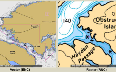
Are You Still Using Raster Charts?
Navigation charts for Northwest waters on both sides of the border are in the midst of a major change. In 2019 NOAA announced plans to “Sunset” U.S. Raster chart products. Similarly, and with less fanfare, Canadian Hydrograph Services (CHS) activated plans to...

Why Your Chart Plotter Isn’t Up-To-Date!
Chart plotter manufacturers such as Simrad, Garmin, Furuno, and other proprietary hardware manufacturers rely on charts from chart vendors such as Navionics, Garmin, and C-Map. The valuable information in these charts comes from NOAA for U.S. waters and from Canadian...

Canadian Raster Charts Discontinued
Canadian Raster Charts Discontinued Canadian Hydrographic Services just announced plans to discontinue all of its digital Raster Navigational Charts (RNC) offered in BSB format. The process will be in progressive phases. The first phase will include West Coast charts...

Are You Prepared to Navigate in Fog?
It's a beautiful spring day in Seattle...the sun is sparkling on the flat calm water of Puget Sound, it's just warm enough that you don't need a jacket and the mountain is out!...how could you ask for anything more??!! You prepare to leave the dock, disconnect and...
NOAA is discontinuing printed tide and current tables
What does this mean for you?If you have been using the USCG-approved Tide and Current Tables, this year is the last year that you will be able to do so. Lovers of printed tide books will be disappointed to learn that the National Oceanographic and...

NOAA The Sunsetting of Raster Charts; The Dawning of New Vector Charts
November of 2019 NOAA published their timeline and plans to phase out all raster chart products in favor of vector charts by January of 2025. More than two years prior, NOAA published a Draft National Charting Plan, which included plans to phase out raster...

Magnetic North is on the Move!! (and why we shouldn’t worry)
Should we worry that the Magnetic North is on the Move? Recently the news media is full of alarming reports that the Earth’s magnetic field is rapidly changing. Some suggest that this is the precursor to a complete reversal of the magnetic poles, during which the...