Canadian Raster Charts Discontinued
Canadian Hydrographic Services just announced plans to discontinue all of its digital Raster Navigational Charts (RNC) offered in BSB format. The process will be in progressive phases. The first phase will include West Coast charts listed below; for a full list of charts affected in the first phase, see https://notmar.gc.ca/publications/monthly-mensuel/west-ouest-06-21-en.pdf. The process will start with charts in the south and move north. CHS notes that discontinued raster chart areas have up-to-date Electronic Navigation Charts (ENCs) available. Active subscriptions to discontinued Raster charts will be transferred to ENC charts. Paper charts produced from ENC charts will be made available.
CHS is soliciting comments from mariners and users of charts regarding this planned action, comments are due by September 23, 2021. CHS notes that comments must include factual basis along with supporting information for safety, commerce, and public benefit. Comments should be directed to the following email address: chsinfo@dfo-mpo.gc.ca .
West Coast Charts
3410 Sooke Inlet to/à Parry Bay
3411 Sooke
3412 Victoria Harbour
3419 Esquimalt Harbour
3424 Approaches to/Approches à Oak Bay
3473 Active Pass
3477 Plans Gulf Islands
3478 Plans Saltspring Island
3479 Approaches to / Approches à Sidney
3490 Fraser River/Fleuve Fraser – Sand Heads to/à Douglas Island
3491 Fraser River/Fleuve Fraser – North Arm
3492 Roberts Bank
3493 Vancouver Harbour – Western Portion/Partie Ouest
3494 Vancouver Harbour – Central Portion/Partie Centrale
3495 Vancouver Harbour – Eastern Portion/Partie Est
3496 Approaches to / Approches à Vancouver Harbour
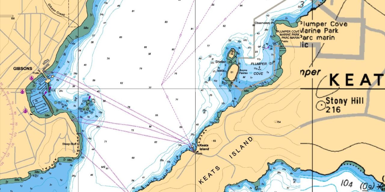
3534 Plans Howe Sound
3721 Plans – Pitt Island
3726 Laredo Sound and approaches
3727 Cape Calvert to Goose Island Including Fitz Hugh Sound
3728 Milbanke Sound and approaches/et les approches
3744 Queen Charlotte Sound
3902 Hecate Strait


