
The Stikine River, which means Great River in Tlingit, runs 380 miles from its headwaters in British Columbia to its mouth near Wrangell. The Stikine was used by the Coastal Tlingit as a transportation route to the interior region. The Tlingit of lower Stikine traded with the Tahltan people who lived farther upstream. The word Stik’iin is a name for the Tahltan people in the Coast Tsimshian dialect.
The Stikine River carves through glacial valleys, canyon walls, and ends in a huge delta area. Naturalist John Muir in the late 1800’s recorded over 300 glaciers along the river’s course. The delta near Wrangell is 16 miles wide, extending from the river mouth almost to the town itself and varies in depth from 3 feet to 15 feet at a plus 11-foot tide.
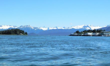
Several small-draft tour boats at Wrangell offer boating adventures up the Stikine River. On one of our recent trips to Wrangell, we signed-up for a tour with Captain Zachary Taylor, with Muddy Water Adventures, a third generation Wrangell local who made our river excursion even more exciting by sharing his knowledge of local history and past events.

Heading through the delta, skirting around trees and stumps grounded in 3 feet of water, we passed Sergief Island, where a dairy farm once operated. In earlier times, cows were barged to the island from Wrangell, where the cows ate the lush spring and summer vegetation. This farm was the source of milk for Wrangell residents. Before winter set-in, the cows were barged back to Wrangell and herded down Cow Alley located between Church Street and Front Street. Just north of Sergief Island is Farm Island, where Wrangell locals have summer cabins accessed by boat along the delta.
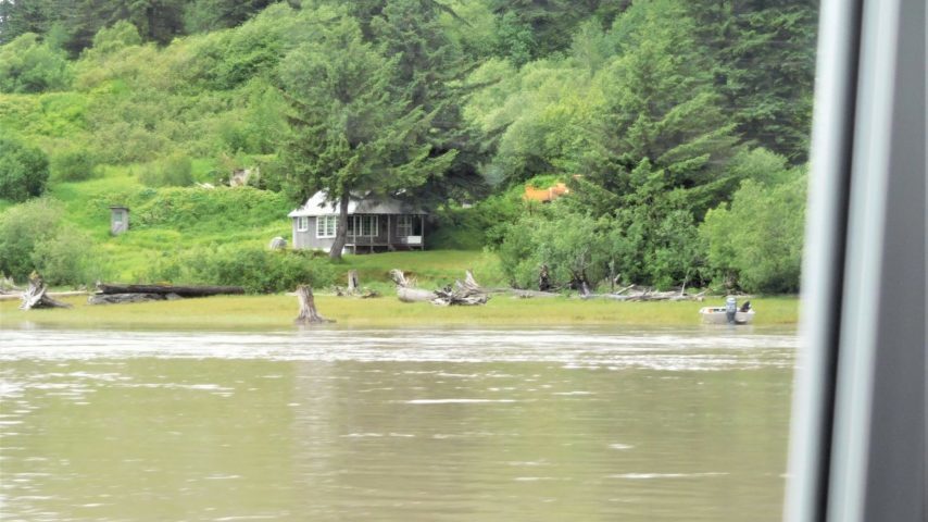
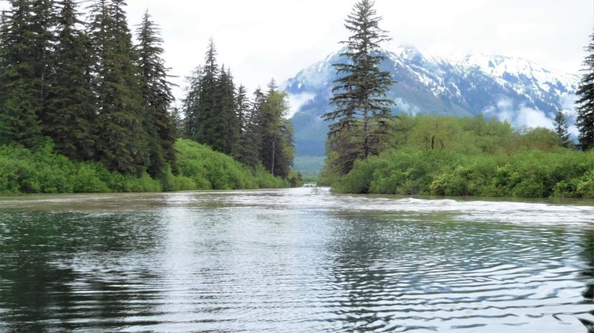
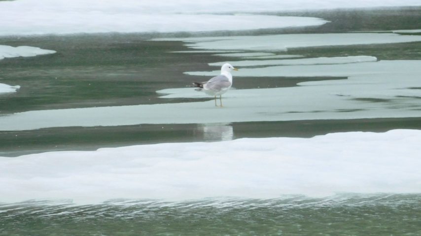
Once through the delta, we were on our way up the Stikine, watching for bear, moose, and otter as well as various species of migrating birds and shorebirds. Zach soon spotted a black bear on one of the icefields high above the river. To our surprise, cabins and huts on floats dot the shoreline, most of them tucked-in among the trees. These huts are used for lodging while fishing on the river and can be moved to different locations as the course of the river changes due to silting and ice melt. There are even three permanent U.S. Forest Service cabins to rent for those who want to spend the night in this river wilderness.

The Stikine consists of main channels, smaller side channels, and tributaries, varying in width from nearly 700 feet wide to as little as 6 feet wide. The Stikine’s north arm empties into Frederick Sound, while its main arm and southern tributaries empty into Sumner Strait and Stikine Strait. Our excursion took us through narrow channels and wider main channels, with current running up to 5 knots.
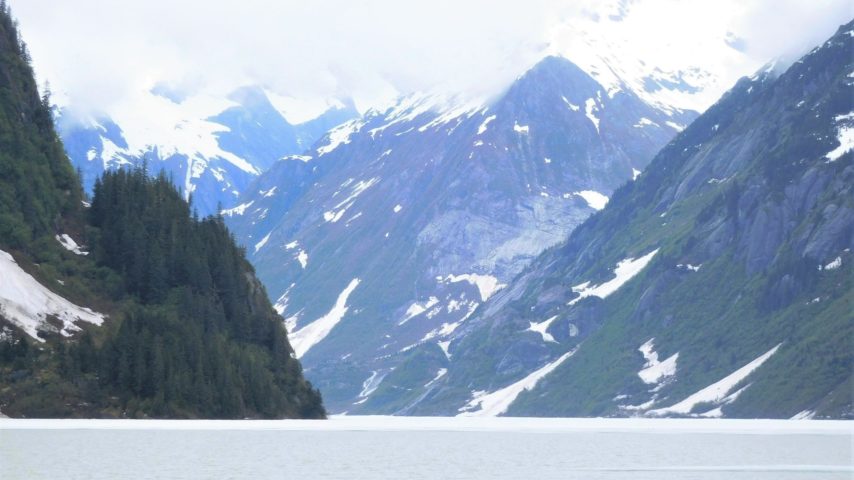
As we neared Shakes Slough, layers and chucks of ice that make their way down river from Shakes Glacier created more obstacles to maneuver around. Before reaching Shakes Glacier, we stopped at one of many lovely waterfalls, nosing the bow of the boat underneath the falls.

Shakes Glacier is named for the powerful line of Tlingit Chiefs of Wrangell. One of these Chief Shakes had a cabin near Shake’s Slough. The Glacier drains the southern portion of the Stikine Icefield and terminates in Shakes Lake. Unfortunately, it is not practical to reach the face of the glacier – in spring and early summer, snow and ice left over from the winter still clogs the frozen lake; by the time the ice melts, calving begins and once again fills Shakes Lake with ice.
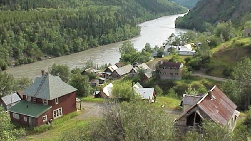
Our river excursion was a pleasant 4-hour day trip. For those who would like to see more of the Stikine River, you can opt for the extended tour to the village of Telegraph Creek in British Columbia, the only village along the Stikine, with a population of about 300. When Europeans arrived in the late 1800’s, there was a plan to link North America by telegraph with Europe via Alaska and Siberia, known as the Collins Overland Telegraph route – the less than feasible line was never completed. The town of Telegraph Creek, however, sprang up and was serviced by sternwheelers able to travel the river of the day.
Around the same time, the Stikine attracted the attention of gold seekers in 1897-1898. Those with dreams of finding gold in the Klondike were fooled into believing that the Stikine was an easy alternative route to the Klondike; when in fact, it was one of the more arduous routes. The Stikine, however, was found to be rich in other minerals. Several railway routes were proposed for an “All Canadian” route to Dawson, but the American government prevented the 500-mile project from proceeding.
A Trip up the Stikine is indeed a fascinating adventure for so many reasons of past and present. The Stikine waters of the U.S. is designated as part of the Stikine-LeConte Wilderness area for recreation and future preservation.