Spring Cruising in the South Puget Sound
Rid Those Winter Blues with A Weekend Outing or Mini Vacation
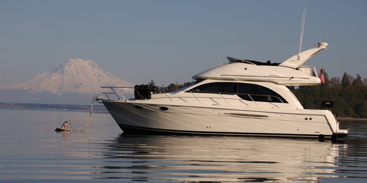
The aroma of brewing coffee fills the cabin. NOAA weather squawks out of the VHF radio. Arlene, and I are enjoying the first morning of a five-day excursion in the southern reaches of Puget Sound. With the sun shining brightly, it was one of those wonderful spring days in the Pacific Northwest – boater’s dream. Enjoy cruising in the South Puget Sound this Spring.
South of the Tacoma Narrows lies approximately 200 square miles of pure boating pleasure. The area consists of 17 islands, eight passages, countless peninsulas, inlets, bays and coves to explore. Twenty-one percent of the Washington State’s marine moorage sites are here. Best of all, those who live in the greater Seattle-to-Olympia area don’t have to travel far to enjoy this boating wonderland.
What's for lunch?
Steamed Clams on a nice Spring Day!

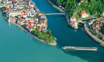
We have explored this region many times, but we still get excited every time we point Easy Goin’sbow towards Tacoma Narrows, the gateway to the southern portion of Puget Sound. The Narrows, as the locals call it, was formed over a million years ago by a continental glacier. It separated the Kitsap Peninsula from the southwest portion of the city of Tacoma.
Some mariners are uncertain about this part of the trip, and well they should be. In the spring, currents can surge through the Narrows at speeds near 6-knots. We plan our trips through the Narrows to coincide with slack water or to get an extra boost by catching the southerly flood.
Once south of the Narrows bridge, we turned to starboard, entered Hale Passage between Fox Island and the Kitsap Peninsula, and headed west towards Carr Inlet. Outlined with beautiful waterfront homes, the 4.5-mile-long scenic passage provides a wonderful view of the Olympic Mountains.


Penrose Point
Our choice for the first night of the trip is Penrose Point State Park which is our favorite state moorage in the inlet. Located 2.5-miles southwest of Hale Passage, the park offers 270-feet of dock moorage and eight mooring buoys. The dock and three of the buoys are located on the west side of Penrose Point in Mayo Cove. The other five buoys are located on the east side of the point.
When we enter Mayo Cove, we do so with caution due to the twin shoals well offshore. One shoal extends northeast from Penrose Point, and the second lies to the 300-yards west of the point in Mayo Cove and extends half mile out from the beach. When navigating the area give the shoals a wide berth by staying toward the middle of Carr Inlet until you can clearly see Lakebay Marina before turning towards Mayo Cove. Both shoals offer great beachcombing at low tide.
If your destination is the park dock, keep an eye on the sounder as you make your final approach. The channel is shallow and doglegs into the inner bay.
We prefer to stay on one of the buoys on the east side. We have also dropped the hook in the area, over a good-holding bottom of mud and sand in 20 to 30-feet. This side of the park is a bit more tranquil and has a view of Mount Rainier. It’s common to see wildlife on the beach or bald eagles soaring overhead.
The park offers nearly two-miles of saltwater frontage and 2.5-miles of hiking trail winding through impressive stands of fir and cedar that share space with ferns, and rhododendrons.
For us, one of life’s little pleasures is a nice pot of steamed clams with garlic bread for lunch or dinner. On previous trips to the park, we have enjoyed the plentiful clams and oysters, and this trip is no different.
Moorage Fees
Daily park fees are 70-cents per foot on a dock, with a $15 minimum, and $15 for use of a mooring buoy per night. If you plan to stay more than four or five nights a year at state park moorages, consider an annual moorage permit. The permit fee is $5/foot with a minimum of $60 and is good for either park docks, linear moorage or buoys. Vessels over 45 feet are not permitted to moor on park buoys. For more information, visit parks.wa.gov
The next morning, we headed south from Penrose and navigated through Pit Passage between McNeil Island and Key Peninsula. We always traverse the passage slowly, with one eye on the depth sounder and the other on the navigational aids that mark the channel.
Once we clear the south end of the passage, its back up to speed and through Drayton Passage, around Devils Head and into Case Inlet, with our choice of several state moorages.


Jarrell Cove
On this day, our destination is Jarrell Cove State Park on the north end of Hartstine Island. A 67-acre park with 3,500 feet of saltwater shoreline on the northwest end of the island. The park offers boaters 14 moorage buoys,650-feet of dock moorage – with 30-amp power – a hiking trail and miles of island roads for stretching your legs. This small, pleasant cove is sheltered even in the worst of weather.
We enjoy mooring to a buoy and relaxing for a couple days. If we rise early, there’s a chance we’ll spot deer on the beach, osprey overhead or an oyster tug through the morning mist, hauling up Pickering Passage with its take.
The small marina and store across the cove are open from Memorial Day weekend through Labor Day. In the off-season fuel is available by appointment.
After two days of relaxing, exploring the cove by dinghy, and hiking we motored out of the cove, turned to port and headed 6.5-miles down Pickering Passage for Hope Island State Marine Park.

Hope Island
Purchased by the state in 1990, this quiet 106-acre island between Squaxin and Steamboat Islands is covered with forest and features 2-miles of hiking trails.
If the five mooring buoys are taken, there’s a good holding bottom for anchoring in 20-25 feet of water off the island’s eastern shore. There are some shallow areas extending out from Squaxin and the current runs swift at times.
The afternoon was spent trolling for sea-run cutthroat trout from the dinghy along the island’s shoreline. With a falling tide and setting sun, we were lucky enough to hook and release a half-dozen fish. In Puget Sound, cutthroat trout is a hook and release fishery. These feisty fish are a tremendous amount of fun on light tackle.
During dinner, the discussion turned to returning home and how to maximize the amount of enjoyment out of the limited time left. Arlene suggested a lunch stop at Eagle Island State Park on the way home.
Eagle Island
After breakfast, we set a course for Eagle Island located in Balch Passage. For whatever reason, many boaters miss this tiny, 5-acre jewel of a park.
Although it is undeveloped and has no facilities on shore, there are three mooring buoys (two located on the west side and the other off the eastern shore). The beach is pleasant and smooth but use caution, there is poison oak reported amongst the vegetation farther inland. The island makes for a great mid-day stop. We ate lunch while enjoying the antics of several curious harbor seals and a wonderful view of Mount Rainier.
After lunch, we headed for home. Once again, the currents were in our favor and before we knew it, we have passed out the gateway we entered five days before, now refreshed and looking forward to our next visit to the southern portion of Puget Sound.


Additional State Parks South of the Tacoma Narrows
- Cutts Island – two-acre island in Carr Inlet; eight mooring buoys.
- Kopachuck – 280-acres; 5,600-feet of shoreline on Henderson Bay; two-mooring buoys.
- Joemma Beach – 106-acres; 3,000-feet of beach on Case Inlet; 500-feet of seasonal dock.
- McMicken Island – 11.5-acre island on Case Inlet; five mooring buoys.
- Stretch Point – Carr Inlet; day-use only; five mooring buoys.
- Tolmie – 154-acres off Nisqually Reach, marine day-use only; five mooring