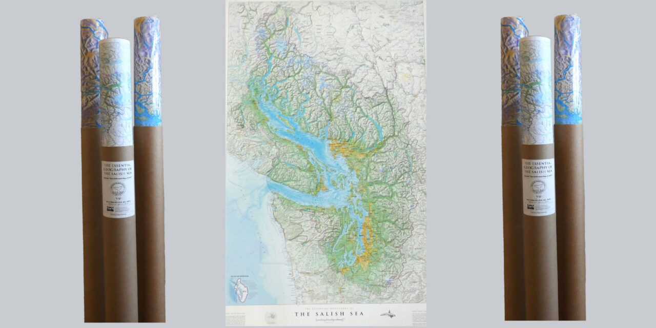
Clark Geomatics has introduced their newest map, the Geography of the Salish Sea, now available for purchase at the Waggoner Book Store. This beautiful map is suitable for framing and hanging in your office, home, vessel, or yacht club. The detailed, vibrant map created by Cartographer Jeff Clark, shows the many layers of natural features, culture, and history of the region.
The Salish Sea extends from the north end of the Strait of Georgia and Desolation Sound to the south end of Puget Sound, and west to the mouth of the Strait of Juan de Fuca. These separately named bodies of water form a single ecosystem that spans across the international border. The name Salish Sea was adopted in 2010 by the Province of BC, the Washington State Board on Geographic Names, the Geographical Names Board of Canada, and the U.S. Board on Geographic Names, as proposed by marine biologist Bert Webber of Western Washington University in 1988. While the name Salish Sea is not a historical term, it does pay tribute to the Coast Salish peoples who inhabited the area long before the arrival of Europeans.
The geographic features of the Clark Salish Sea map, provide an eye-pleasing overview of the terrain, including mountains, rivers, valleys, and lakes. Colonial and Indigenous place names promote cross-cultural understanding, combining a wealth of information. The color scheme was derived from satellite imagery and resembles colors that one would see from an airplane.
Clark Geomatics, located in North Vancouver BC, suggests that maps not be left tightly rolled, but rather taken out of the mailing tube and laid out so that the map can flatten. Although the map is printed on premium coated photo paper with fade resistant inks, it is best to keep the map out of direct sunlight.
In addition to purchasing the new Salish Sea map at Waggoner, you can also purchase the colorful, laminated planning maps of the Inside Passage by Fine Edge, now in stock – both the North Portion of the Inside Passage, and the South Portion of the Inside Passage – taking you on a visual trip from South Puget Sound through British Columbia and Southeast Alaska. These large, vertical maps are great conversation pieces and provide an overview of the extensive waterways of the Pacific Northwest, with details that you can share with your boating guests and friends, or admire for your personal enjoyment.