Southeast Alaska – Group I
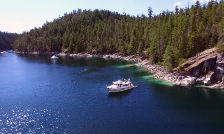
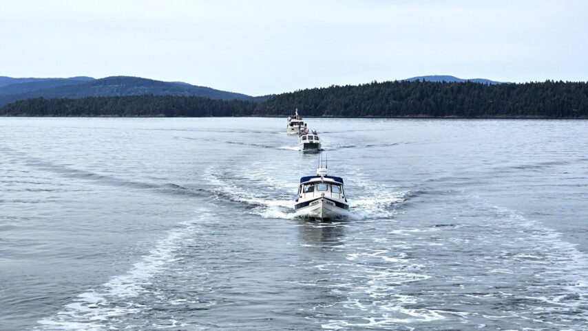
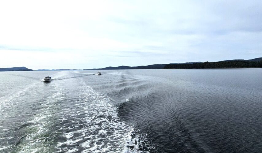
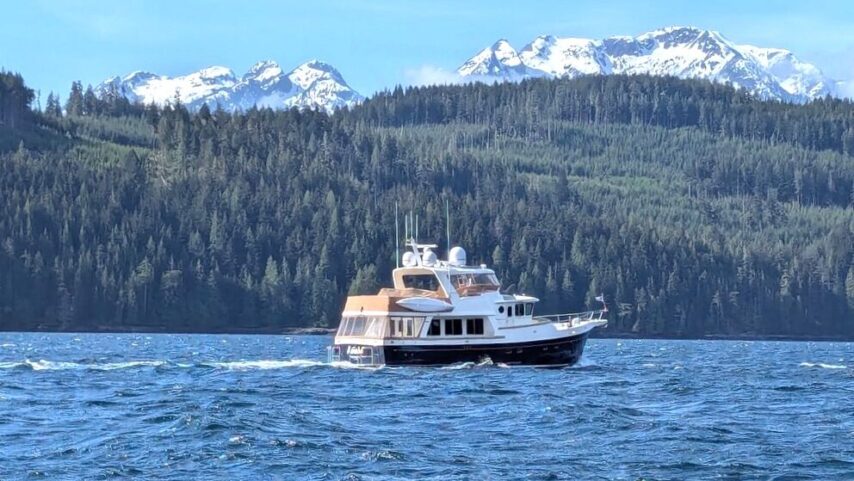
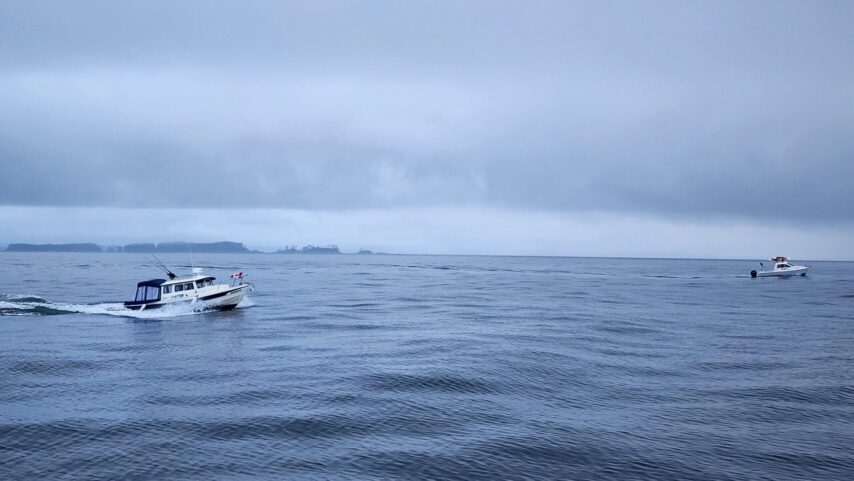
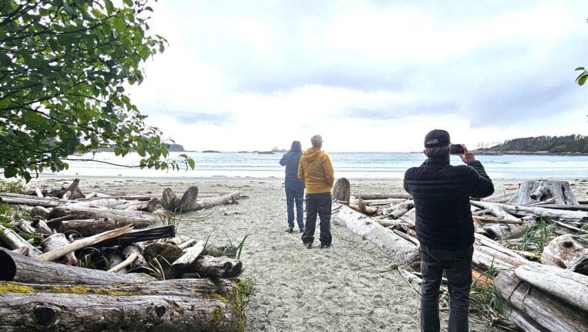
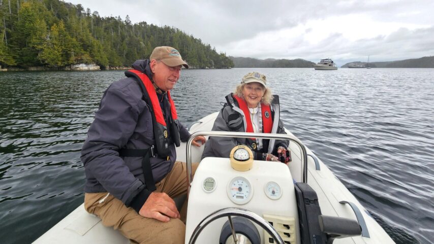
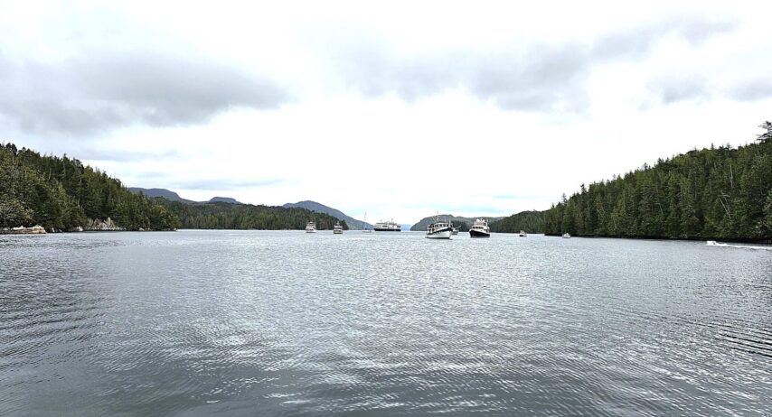
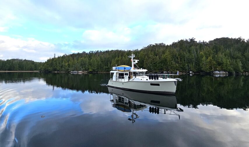
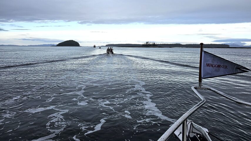
Kyle and Ashley Ripley led a Waggoner Flotilla from Anacortes, WA to Petersburg, Southeast Alaska during the month of May. The group’s 24-day north-bound trip stopped at marinas, anchorages, villages, and towns along the Inside Passage. Group gatherings along the route provided opportunities to make new boating friends, become acquainted with fellow Southeast Alaska summer adventurers, and view wildlife.
YOU CAN READ ABOUT THE MAY FLOTILLA ADVENTURES BELOW:
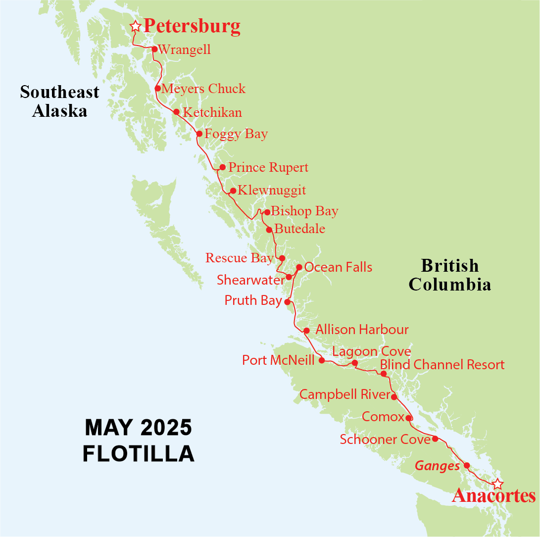
DAY 1 – ANACORTES, WA TO GANGES, SALT SPRING ISLAND, B.C.
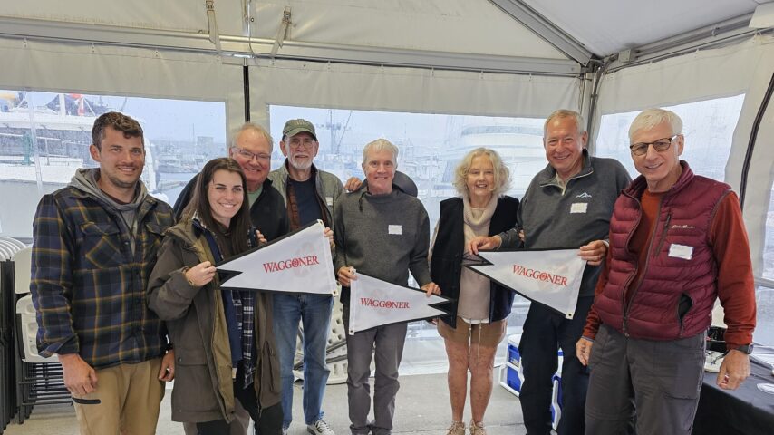
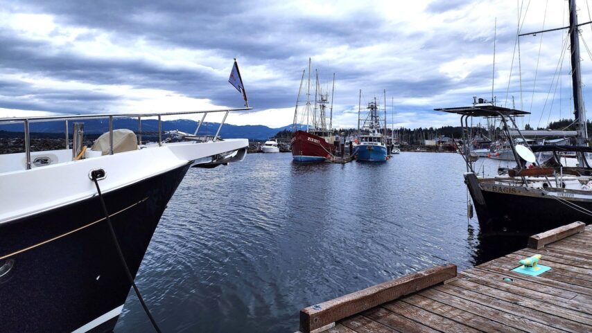
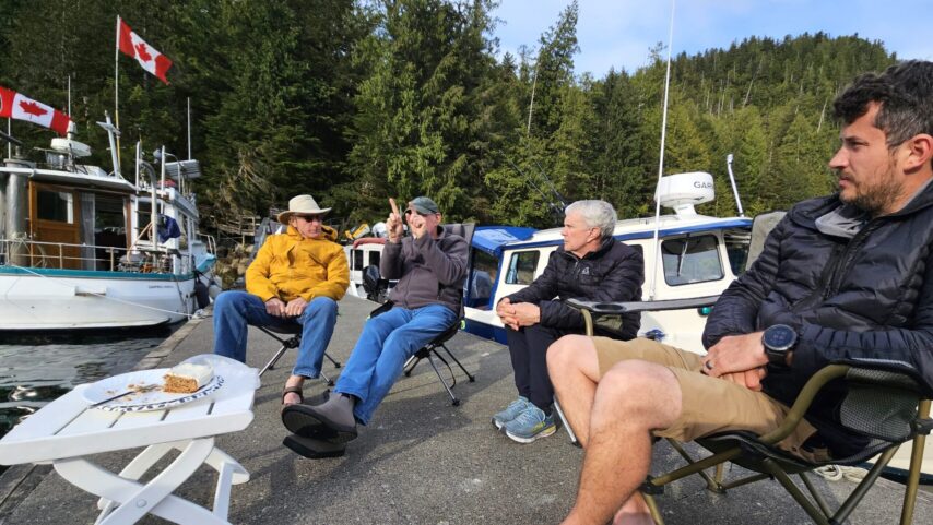
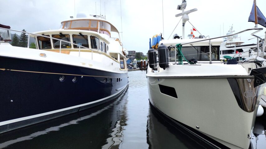
Participants of the May Waggoner Flotilla gathered at Cap Sante Marina for a fun sendoff prior to their morning departure on May 8, with much anticipation and excitement to begin their adventure.
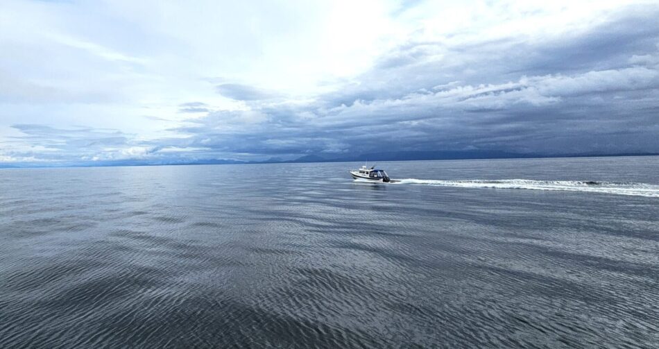
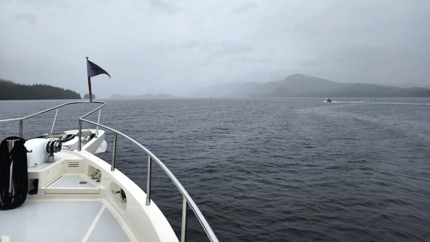
The flotilla departed Anacortes around 8 am, crossing Rosario Strait with an ebb current and transited Thatcher Pass and Harney Channel before heading north through Boundary Pass.
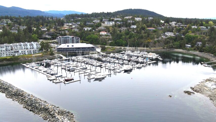
The group cleared customs in Bedwell Harbour around 1:00 pm. Flotilla Leaders Ashley & Kyle made tacos for the group before heading off to Ganges on Salt Spring Island. The group stocked up on galley supplies in Ganges, where grocery options included Thrifty Foods in Downtown Ganges, and the Country Grocer in Upper Ganges accessed by a complimentary shuttle, which runs until 4 pm.
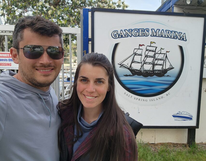
An evening of relaxation was enjoyed over dinner at Auntie Pesto’s, one of the best restaurants in Ganges.
DAY 2 – SALT SPRING ISLAND TO FAIRWINDS MARINA
The group’s 7:15 am departure from Ganges was via the western shore of Galiano Island, reaching Porlier Pass for a transit (west to east) near slack water around 9:30 am. “Lining up like Mother Goose, we transited Commodore Pass near Page’s Marina.” It was an opportunity for flotilla participants to experience some rocking, yet with plenty of depth.
“We could have gone around, Whiskey Golf (WG) which looked more like a lake on a warm summer’s day than a military testing ground. The joke that keeps coming around is that we PACKED the good weather with us in our ship stores.”
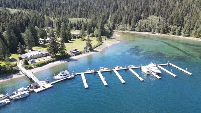
After safely arriving at Fairwinds Marina located off the Strait of Georgia in Schooner Cove, the group walked the new docks, which were completed this last winter. The marina offers lodging options and complimentary golfclub rentals; “borrowed games from the office was enough to keep us entertained for the evening.”
The group gathered for Happy Hour and the Captain’s Daily Briefing at the Fairwinds Cafe/Restaurant, “it was hard to not give in and eat dinner there too.” The lead boat, Annie, hosted dinner – Pork Loin, pan-fried cauliflower, and potatoes. Plans were made that evening for the next day’s journey to Comox. “It was hard to leave Fairwinds Marina the next morning, having used their free laundry and shower facilities; we felt like little crabs coming out from under our rock for a mid-day sun soak.”
DAY 3 – FAIRWINDS MARINA TO COMOX
Lead boat m/v Annie and her flotilla pushed off the docks at 7:30 am in 1-5 knot winds and calm seas, anticipating 10-15 knot winds to build in the evening. 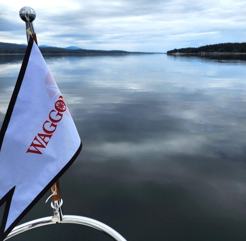
The group transited Baynes Sound on the west side of Denman Island, where a cable ferry crosses from Buckley Bay on Vancouver Island to Denman Island.
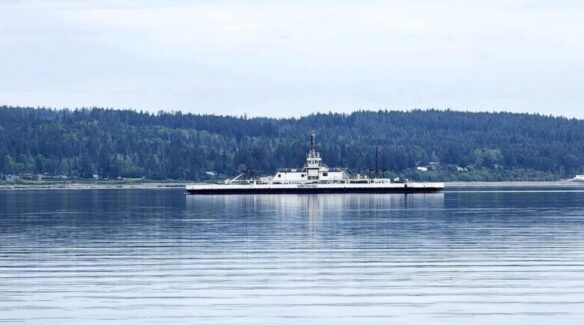
The cable is pulled tight off the bottom and boaters need to check the ferry terminal light – green for safe passage, and red means wait!
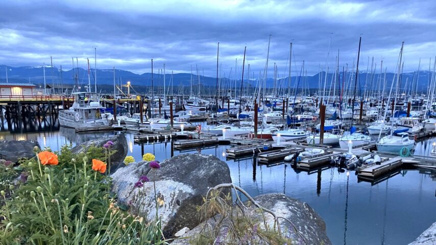
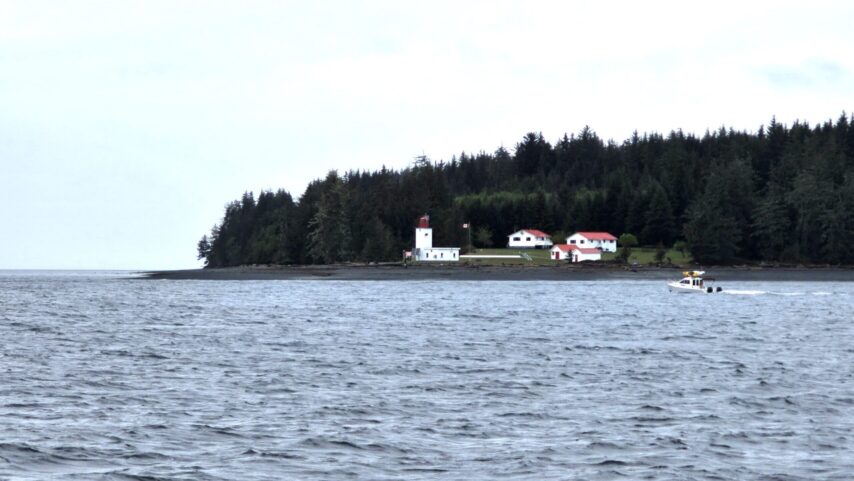
While Comox Valley Harbour Authority does not take reservations, arrival of the Waggoner flotilla was expected and moorage space for the group was accommodated accordingly. The first breeze started to skim across the flat bay upon our arrival around 12:30 pm. Comox is a delightful community with book stores, a small shopping center, gift shops, and some great restaurants, a bakery, gelato shop, and now a macaroons shop called “OMG Macaroons.”
DAY 4 – COMOX TO CAMPBELL RIVER
The flotilla departed Comox around 7:30 am, leaving ample time to get to Campbell River. The flotilla transited the well-marked Comox Bar, carefully checking the charts as they went.
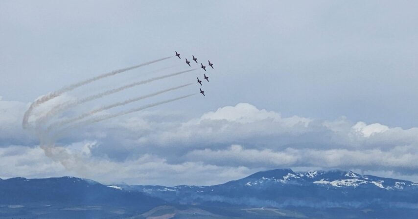
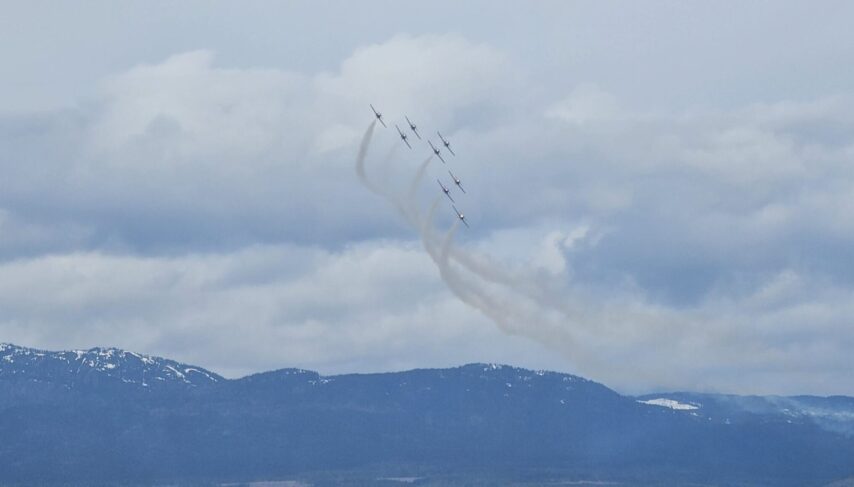
Soon after their departure, they got a private air show from the Canadian Snow birds – “a spectacular show, our jaws were dropped in awe! Cheering and waving from our boat decks, they practiced spins and barrel rolls, you name it, they performed it.” The flotilla group was left with true Canadian awe.
Proceeding on to Campbell River (32nm with little to no wind), the group timed the entrance into the marina near slack (around 11:30 am), with a gentle push around the breakwater. Campbell River is a great place to provision – “food, office supplies, small batteries, plumbing pieces – there was something for everyone.”
Flotilla leaders Kyle and Ashley had lunch at Royal Aroma, one of those hidden gems, Indian cuisine restaurants. A stop at “Freyja – The Croissant Story” was on their list of musts. The group met up for an early dinner at a Canadian classic, “The White Spot” which has great burgers, milkshakes, and some delicious happy-hour appetizers. “We chatted over our daily brief for the next day, knowing that some of us had a 5:00 am departure to make the early 5:45 am Seymour Narrows transit; we readied out small ships for the early morning departure.”
DAY 5 – CAMPBELL RIVER TO BLIND CHANNEL RESORT
Another nice weather day with northwest winds 1-5 knots, mostly sunny. Departed Discovery Harbour at Campbell River around 5:00 am to transit Seymour Narrows near slack water at 6:00 am, with a 2 knot push through the Narrows. Seymour Narrows is wide enough for boat traffic going both directions, and it’s not uncommon to see barges and log booms. We made a welcome stop on the north side of the Narrows, dropping the hook in Kanish Bay (near the Chained Islands) for a second cup of coffee and an opportunity to do some fishing for the night’s dinner. Faster boats in the flotilla approached slack at Seymour Narrows around 10:15 am. After our slower boats had their second (maybe first) breakfast, we weighed anchor and proceeded northwest up Johnstone Strait then northeast up Mayne Passage to arrive at Blind Channel Resort, staggering boats so as to wait for assistance from the Resort’s staff. Our timing was good for slack water, making for easy docking.
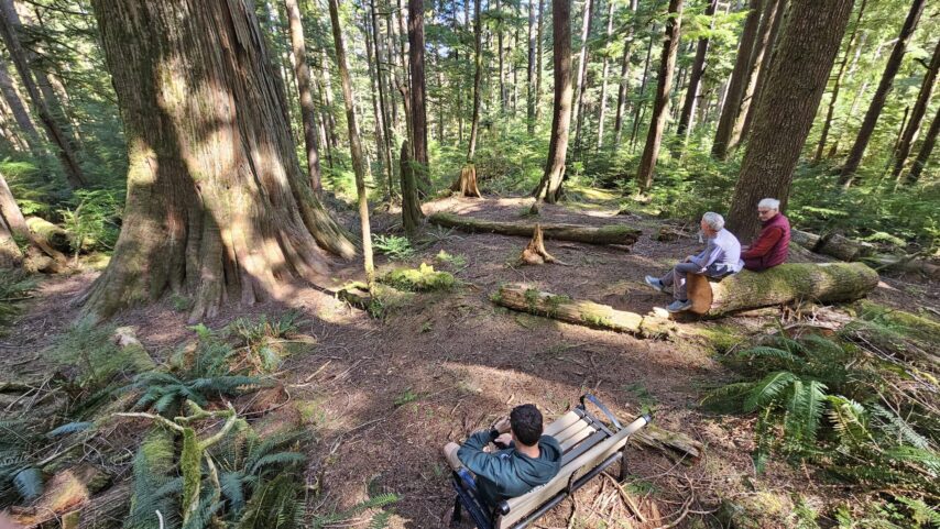
We were impressed with the beautiful grounds at Blind Channel Resort and took our time exploring the area.
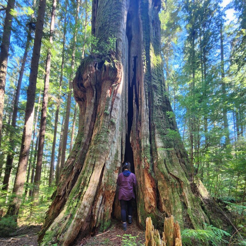
Some of the flotilla participants hiked the trail to the “Big Tree” – we estimated its trunk to be at least the hand-holding width of 10 people. We found a few other large stumps left behind from the earlier logging days, and found one trunk with the standing board still in place.
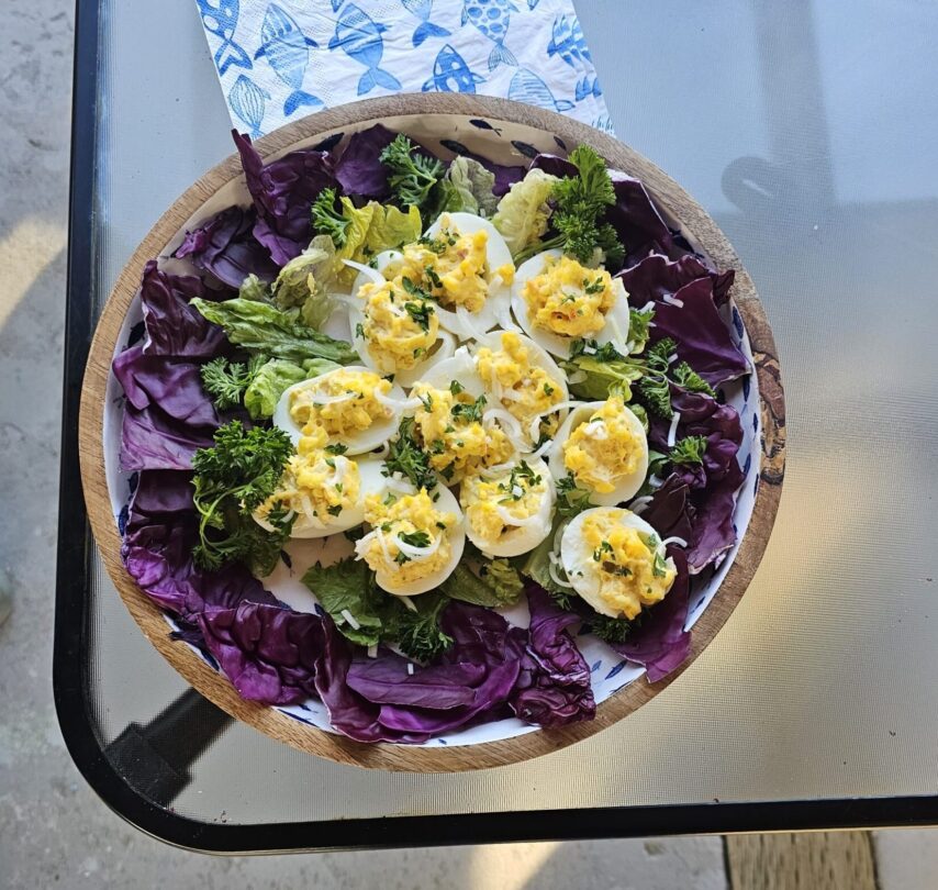
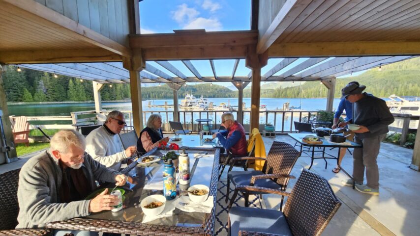
The group enjoyed a potluck dinner under the lovely covered structure overlooking the marina docks – Ashley brought Mongolian Beef, Yum! and Karen Bond made delicious deviled eggs. We reviewed the briefing for the following day, weather is expected to move in. We finished up with a group photo and headed back to our boats ready for the next day’s voyage.
DAY 6 – BLIND CHANNEL RESORT TO PORT NEVILLE
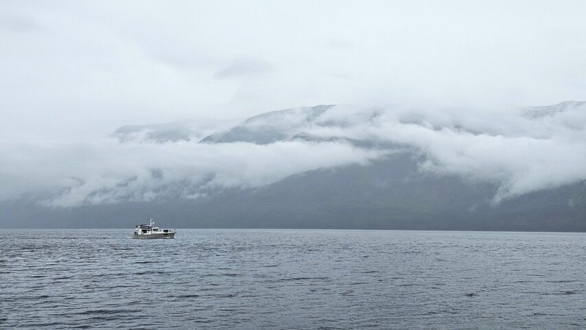
The group departed Blind Channel taking the “back route” through Chancellor Channel via Greene Point Rapids, then Wellbore Channel and Sunderland Channel, reconnecting with Johnstone Strait. “The weather caught up with us, or we caught up with the weather.”
Johnstone Strait can be a beauty and can also be a beast.” The turned weather reminded us how swiftly mother nature can change her mind.” Due to the weather, the group’s progress became too challenging and their timing would be off for the currents at Lagoon Cove so they ducked into Port Neville, offering anchorage and a public wharf.
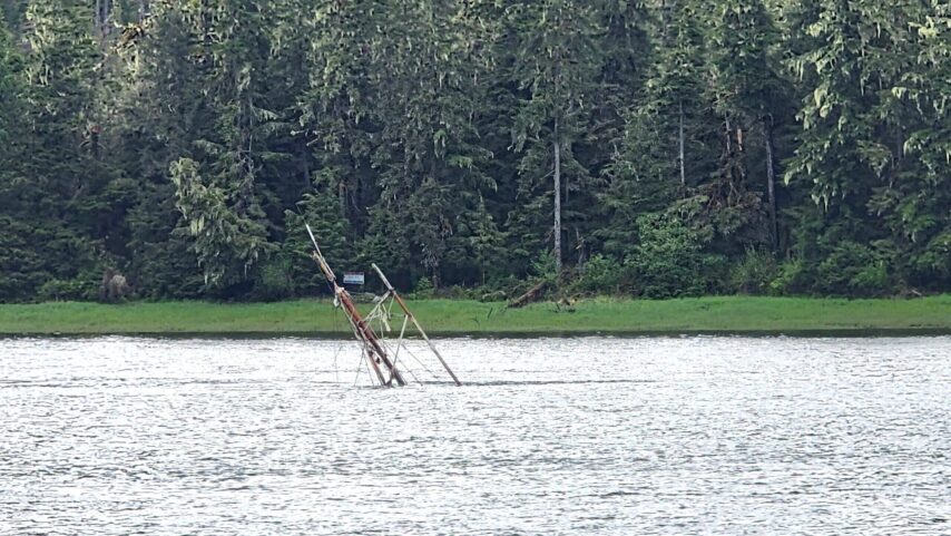
The public wharf and the old post office store at Port Neville is rich in history. A Reader Board at the head of the wharf documents the years of history and information regarding the family that used to live here. Three of the original buildings from that era are still standing.
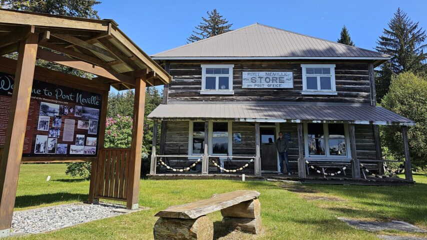
“We appreciated this safe anchorage. The soft sandy white beaches felt incredibly out of place, yet wildly welcoming.” Only a few more miles of exposure in Johnstone Strait and we will be back in protected waters again for our Lagoon Cove destination, 22nm from Port Neville.

DAY 7 – PORT NEVILLE TO LAGOON COVE
It was a leisurely departure at 9:30 am for our 21-mile journey to Lagoon Cove, with only 8 more miles on Johnstone Strait until reaching the protected waters of the back channels – destination Lagoon Cove Marina on the north end of East Cracroft Island. “We still had shitty weather in Johnstone Strait – the current with us and 20 knot winds against us; everyone fared well. The little boats were able to stick close to the shore and take advantage of the shore lee.
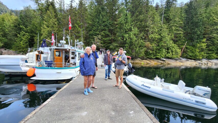
The family that owns and runs the marina was expecting our arrival and greeted us at the dock. Lagoon Cove is such a treat, it is hard to pass up and is a must stop on our pleasure route.
We gathered for Happy Hour around 5:30 pm, a favorite tradition at Lagoon Cove. We were spoiled with fresh caught prawns, homemade soup, fresh bread, brownies, Nachos, and so much more, truly a feast. Everyone enjoyed the opportunity to socialize and share stories with other boaters.
While at Lagoon Cove, some of us adventured out on the hiking trails, making sure to conversate loudly to keep any bears in the area away. Relaxing on the dock, or up at the shop, there is something for everyone at Lagoon Cove. With fuel available, we readied the ships for our passage to Port McNeill for day 8.
DAY 8 – LAGOON COVE TO PORT MCNEILL
Lagoon Cove gave us a wonderful taste of what the Broughtons have to offer. We enjoyed coffee on the dock—courtesy of Lagoon Cove—as we rubbed the peaceful sleep from our eyes. Scheduled for a 07:30 departure, we took the northwest route through Clio Passage into Baronet Passage, and on to Johnstone Strait. It’s amazing what a difference 24 hours can make for weather.
We had calm waters through both passages and along Johnstone Strait, with a gentle 2-knot current giving us a push. After the past two days of wrestling through Johnstone, it was a treat to see her so tamed and settled.
We arrived at North Island Marina in Port McNeill just before noon. William, the harbor master, was attentive and ready to lend a hand if needed. With the wind picking up in the marina, his presence brought a bit of ease to our participants.
The afternoon was spent refueling, grocery shopping, and adventuring around Port McNeill. With about five days to Shearwater—or nine to Prince Rupert—this was our best chance to stock up. We made our way up to the marine supply store at the top of the dock for last-minute items. One of our participants needed something from Port Hardy, and the marina offered to send a staff member to pick it up. North Island Marina truly provides one-of-a-kind service.
Once errands were done, provisions restocked, and our steps counted, we meandered up to Gus’ Bar & Grill, a favorite of ours. There we reflected on the past few days, chatted about boat maneuverability and docking techniques, and wrapped up with our Daily Brief. With our Cape Caution crossing on the horizon, we handed out “Go/No-Go” worksheets to the group. Our goal is not only to lead these participants to Alaska, but to empower them to make the trip on their own in the future—to build both competence and confidence.
With full bellies and a plan for the day ahead, we left the pub. The drizzle that had lingered all day finally cleared, making for a calm, dry walk back to the boats.
DAY 9 – PORT MCNEILL TO ALLISON HARBOUR
Port McNeill is a good staging point to prepare before going around Cape Caution. A well-stocked grocery store is near the docks and our last chance for coffee shops and restaurants for quite some time. Ashley started the next morning with an early walk around town, with a 6:30 am stop at “Mugs 2.0”, a coffee shop up from the marina. They boast wonderful pastries and coffee to warm and calm the soul before any departure. Fresh coffee for us both and a savory scone in hand, we were ready for our 7:30 am departure. With m/v Annie ready to go, the daily engine room check completed, off-the-dock plan established, and shore power cord stowed, we were ready.
Meticulous thought and planning went into our departure. While there was a little bit of southeasterly breeze, 10-15 kts anticipated, it was going in the direction of the current. A sea swell of 4 feet at 8 seconds sounded good. The weather would continue to die down as the day went on and should leave us with an opportunity for rounding Cape Caution on Saturday morning.
As we departed Port McNeill, we stayed in the lee of Malcolm Island through Broughton Strait and headed up as if we were going to Port Hardy. This was our out if we decided the weather was too seedy, it was smooth sailing. We crossed Queen Charlotte Strait and headed through Ripple Passage, the north side of Gordon Channel. We had about 2 knots of push and were only seeing about 5-8 knots of wind from the southeast.
We continued on to Allison Harbor with a light drizzle and arrived at an empty harbor down the long entrance. Bridle hung, dinghy launched, we set off to check on our flotilla participants.
We discussed the “Go/No-Go” weather sheet with others and talked about how to decide on continuing the next morning. How do you make these calls? What stations do you look at? Referring to the Waggoner Guide weather map, we use this as a tool to know what station to use for weather reference. There are many apps to use that help give wind and wave predictions, and we take all of them into consideration.
It was a mellow night in Allison Harbour; a couple of other vessel came in to share the bay. With plenty of room, we all nestled in for the night to prepare for an O’dark-thirty departure.
DAY 10 – ROUNDING CAPE CAUTION TO PRUTH BAY
The weather forecast was in our favor for rounding Cape Caution. We had checked weather for the “Central Coast from McInnes Island to Pine Island” reports and the West Sea Otter weather buoy. The flotilla departed at 4:30 am for the 53 nm to Pruth Bay, 25 miles of which is exposed to the Pacific Ocean. We knew we had a limited window to round Cape Caution before a new front came through. This meant an early departure and meandering out of Allison Harbour to reach the mouth by first light, just before 5:00 am.
Our early morning was well-suited for the journey; a wall of drizzle gave the illusion of fog on the horizon, and there wasn’t a breath of wind. Our smaller vessels hung back with us for a short while as we navigated through the rocks, hazards, and small islands to reach open water.
Once we did, we were met with sleepy four-foot swells with a nine-second period. And zip! – the small boats were off, up on plane, enjoying a smooth and comfortable ride. Cape Caution couldn’t have been better, especially after the previous uncomfortable weather we’d seen in Johnstone Strait.
As we neared protected waters and did our routine 9:00 am weather check, it became clear that the front was moving in stronger and faster than previously anticipated. While our small boats were already close to Frypan Bay in Penrose Marine Park, we decided it would be best to skip ahead a day and continue on to Pruth Bay on Calvert Island. This would give us the opportunity to get ahead of the weather and settle into a better place to hunker down if needed.
When we arrived in Pruth Bay, we were met by other boats and even a National Geographic cruise ship was in the bay. The ship was ferrying people back and forth to shore for tours of the grounds. Anchored and settled in, we made the rounds to check on flotilla participants and complete the captain’s hour with each flotilla boat.
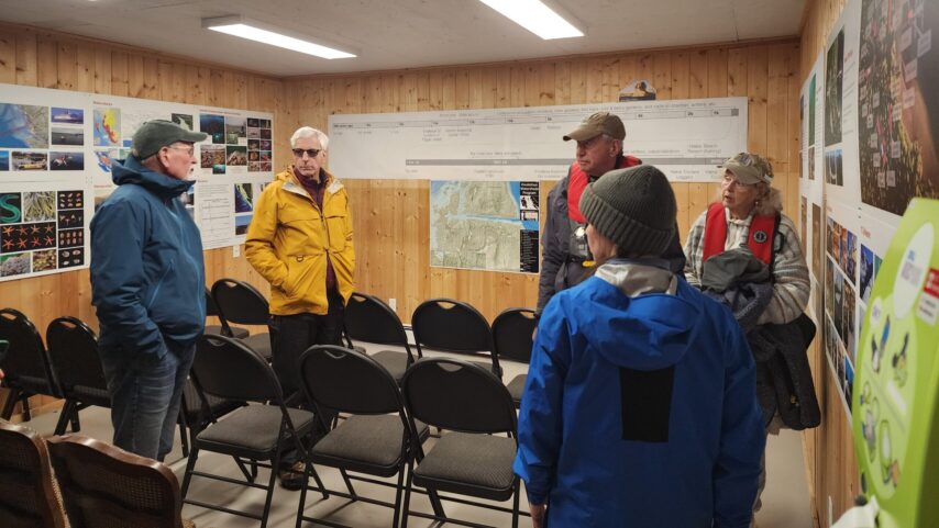
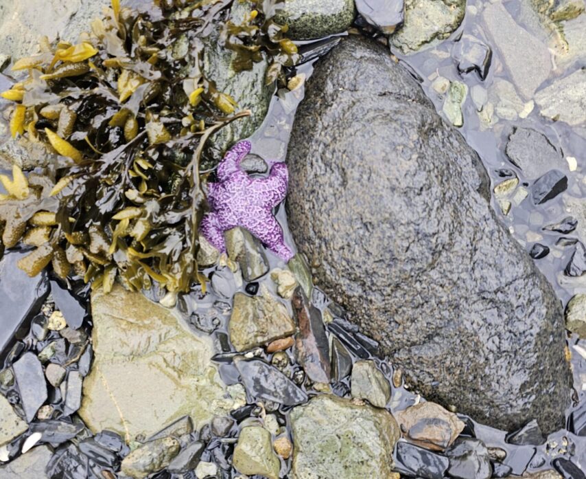
We all explored ashore and visited the Welcome Center. It was wonderful to learn what the scientists and students do here at the Hakai Institute. We were invited to view their observation tanks, which currently houses various sea stars.
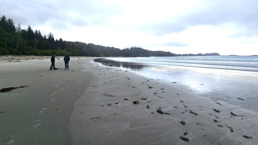
Some of us walked to the renowned beautiful beach via a short trail to the ocean side from the bay. Others had returned to their boats, it was a peaceful night in another beautiful anchorage.
“Pruth Bay was truly a treat. Being able to walk through the Welcome Center and read about what they have learned on that site, and continuing to learn, is such a gift. Then, to take the trail to the beach side was absolutely astonishing.”
DAY 11 – PRUTH BAY TO OCEAN FALLS
After the relaxing evening, we had a semi-early departure. Weighed anchor at 7:00 am sharp and slowly motored along, letting everything warm up and taking in the last of the sights. We had another semi-long day ahead of us to Ocean Falls.
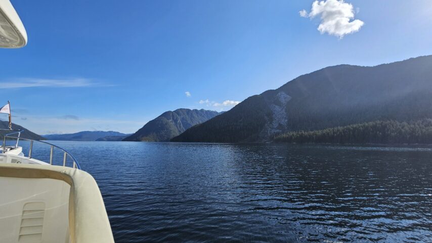
Departing Pruth Bay, we had two options to leave: either continue east down Kwakshua Channel or round Whittaker Point to go down Meay Inlet. We chose the latter. Going this route did expose us to some ocean swell in Hakai Pass, but it’s good practice and a way to learn how different channels may behave in different ways. We then turned north up Fitz Hugh Sound, with smooth sailing the rest of the way to Ocean Falls.
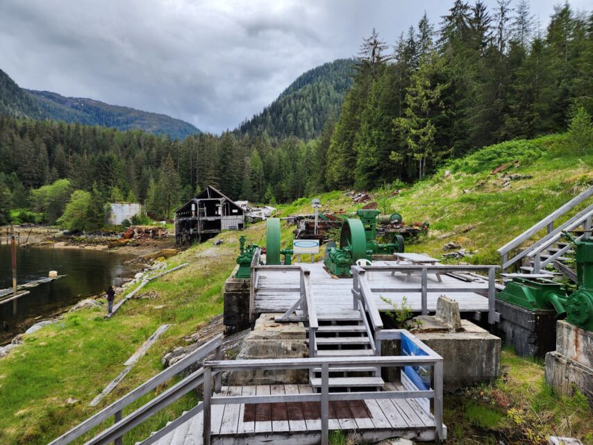
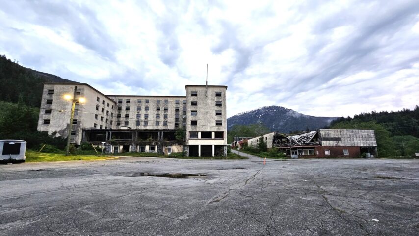 We arrived in Ocean Falls just after 1:30 pm, leaving plenty of time to get off the boat and explore. Ocean Falls is quite the spectacle. Rich in history, there are about 15 full-time residents—five of whom we met. There are two gift shops. One is in the city hall building, where there is also a library. The second is on the corner of the marine ways and the museum. Continue up the hill and you’ll find a bakery/meat shop, as well as some historic buildings with rooms for rent around the grounds. Ocean Falls is one of those modern-day ghost towns that’s fascinating to visit.
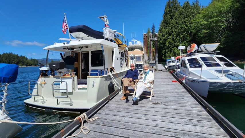
With so much to explore, it was hard to peel off the land for a potluck. m/v “Pacific Crest” hosted us aboard their Nordhavn 41 ft. It was cozy, warm, and filling—filling for the soul and the tummy. We reminisced on the trip so far, all the different places we have been, and dreamed about the places we are going.
Bellies full, Captain’s Hour completed, and eyelids getting heavy, we departed Pacific Crest to ready ourselves for the rest of the night.
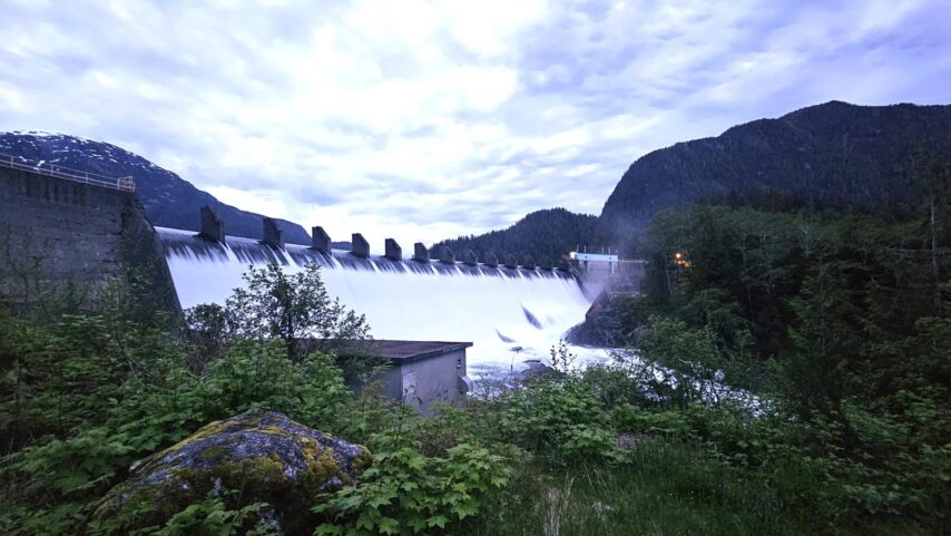
Have you heard of Murphy’s Law? It’s an old friend of ours. Ashley helped a participant with their water pump, while Kyle helped another set up their Starlink. In the grand scheme of things, these were grains of sand on an ocean beach. We were happy to have these as the things to do. Once done, a few of us finished up with a walk to the dam.
We’re all looking forward to the short day to Shearwater that tomorrow will bring. Some of us need fuel, and we all have new sights to see. Continue on we must—for if we spent an extra day in every place that charmed us, we wouldn’t make it very far, our final destination is Petersburg, Alaska.
DAY 12 – OCEAN FALLS TO SHEARWATER
The slower boats kicked off from Ocean Falls at 9:30 am for the 22nm transit to Shearwater. With a later departure time, some of us slept in while others went for a leisurely early morning walk. The goal was to hit Shearwater at low slack tide, giving us a small push of current through Gunboat Passage. The C-Dorys departed a bit later so we could all re-group at the head of the passage.
Ocean Falls sits at the head of Cousins Inlet. From there, we headed south to Fisher Channel, where we just barely caught some of the wind funneling up Fitz Hugh Sound. According to all the weather reports, it was rough out there. Fortunately, we weren’t in Fitz Hugh Sound for long, and we slipped around George Point, which led us to the mouth of Gunboat Passage.
We filed in, one by one like marching ants, continuing through the narrow, windy passage at a modest 8 knots. We call this the “back way” into Shearwater. Once we entered Kliktsoatli Harbour, the wind was howling—we were seeing gusts up to 45 knots. Again, we were deeply grateful for the decision to skip Frypan Bay and move everything forward by a day.
Strategy is key when docking and maneuvering in these kinds of conditions. Annie was the first boat on the dock, tying up on the north side of the main finger—our windward side. This gave a lee for vessels docking on the southern side, directly across from us.
Once everyone was fueled up, plugged in, and dockside, we could breathe a little easier. The C-Dorys have been playing a careful game with fuel and have had to monitor consumption closely.
Each night we calculate their average burn, remaining fuel, and range—crucial numbers as we begin routing for the return journey. We’re now on the other side of the longest fuel stretch, but vigilance remains essential.
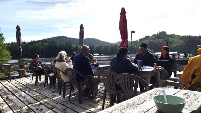
Dinner that night was at the restaurant/pub. We all meandered up around 5:30 pm and gathered at a table in the far back. Captain’s Hour flowed into shared stories and new memories. My favorite part of spending time with boaters is that you never know where the conversation will lead. In a single night, we covered everything from engineering production to software development, free bleeding, and gender fluidity—none of which were on the agenda.
The highlight of the evening, however, was puppy photos from Bill’s daughter, who just welcomed a young Basset Hound into the family.
With our souls full, we wrapped up the evening by helping participants troubleshoot a few issues. The Nordhavn was seeing soot from its generator exhaust—we discussed power loading. The Tomcat’s Wallace heater/stovetop had run out of fuel and was struggling to prime. And finally, C-Otter was having trouble plugging into shore power. One by one, we helped our participants help themselves.
Needless to say, we went to bed proud that night of what everyone has accomplished to get to where we are. Today marked roughly the halfway point. Though we still have a long way to go, we feel ready and excited to continue on.
DAY 13 – SHEARWATER TO RESCUE BAY
There is something steady and secure about being at a dock. No need to launch a tender to go ashore. With power comes the freedom to use electrical conveniences. Water available in a way that gives the illusion of a bottomless shower. But there is also something that creates a hold—this false sense of freedom. Free because you can cast off at any moment, yet fear is allowed to creep in. Maybe it’s easier to stay. Stay out of the weather. Stay tied to security—and to others. Fortunately for us, we have each other. We’re not alone on these trips, and the time spent at anchorage feels like an escape to true freedom. At least, that’s how it feels for me.
Our departure from Shearwater/Bella Bella was around 9:30 am.  A Grumman Goose aircraft was landing just as we were leaving, it was such a treat to see this historic “amphibious flying boat” in action by Wilderness Seaplanes.
From Shearwater to our next stop at Rescue Bay is 32 nautical miles. We chose Rescue Bay for a number of reasons, one being that we don’t have to remain in the exposed section for long as we continue north—specifically where Seaforth Channel meets Milbanke Sound.
Our route included navigating up Reid Passage—a narrow waterway surrounded by rocks and shoals. We exited Reid Passage through Blair Inlet, rounding Promise Point. From there, we continued through Perceval Narrows. Being a narrows, we planned our arrival to line up with slack at low tide. While these rapids don’t carry as much current as the Triple Rapids near Blind Channel, they are still something to contend with—and to respect.
Transiting right on cue, we carried on through Mathieson Channel to Rescue Bay. This anchorage set us up for an early departure through Jackson Passage, while also giving us ample protection from the mild wind in the channel.
We all set our hooks and settled in for the night. After the rain subsided, Ashley and Kyle launched the dinghy and made the rounds. There was a lot to talk about tonight. We were assessing today’s journey and preparing the participants for what comes next. To their surprise, the next two days will be up to them—they will be planning the routes. It’s time for them to truly practice what we’ve been teaching.
It ended up being a quiet evening. Rescue Bay is a safe anchorage with good holding. Mud bottom, plenty of depth. We only saw a six-foot tidal exchange from the high to the overnight low.
Peace and quiet. No bright lights from ashore. We were alone—or at least it felt that way. To us, this is what it’s all about.
DAY 14 – RESCUE BAY TO BUTEDALE
Things are great—until they’re not. And in the moment when life hits a speed bump, there’s no telling how steep the mountain ahead will be until you’ve reached the top.
Waking up in a place like Rescue Bay feels like a dream. It’s quiet, far from the bright lights of shore—no people walking down the dock peering into your home. But that’s the catch-22: you’re alone. If something breaks, you’d better hope you have the part—or at least the ability to limp to your nearest town where you might be able to find a part or help.
Lucky for us, this morning’s mountains were more like long steep rolling hills. Annie was scheduled for a 7:00 am departure. That means the hook is raised and we’re ready to go. We check in on the VHF about five minutes prior to departure, letting everyone know we’re raising anchor.
Then it happened, the call from C-Otter: “My engine won’t start.” You could hear the concern cracking through the sleep still in his voice. “Troubleshooting now… batteries are good, motor’s in neutral… I’ve got a couple more things to try…” He trails off.
No one can know your boat better than you. You know where your gremlins lie—the hidden switches, the quirks in the startup sequence that keep your gal content. These beasts we call boats aren’t just vessels; they’re homes. They’re family. They protect us at night and carry the things that make this journey possible. There’s a deep sense of security in knowing your boat—not just knowing it, but being able to troubleshoot and problem-solve the hiccups along the way. That alone can carry you further than you might believe.
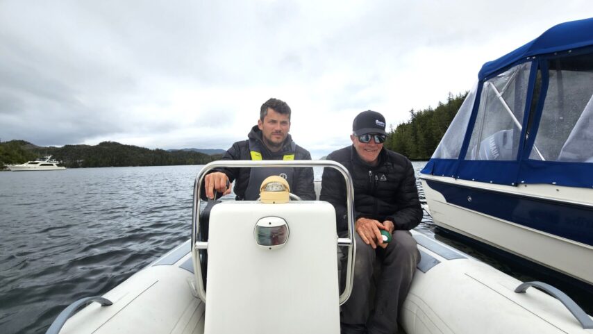
“Is it trying to start, or is there nothing?” Kyle’s voice came through with calmness that blanketed the bay. What felt like a millennium was, in reality, only seconds. “Nothing. It’s not even trying,” C-Otter nearly whispered. “Okay, stand by,” Kyle replied calmly. You could hear the gears turning. At this point, Kyle and I had already devised a plan without speaking. In moments like these, I swear we’re telepathic. I was at the helm, preparing to set the hook, while Kyle prepped the dinghy for launch.
“She’s fired up! She started!” I didn’t know Scott could sound that excited so early in the morning. “That’s great news, C-Otter.” You could hear Kyle’s smile across the mic—relieved we didn’t have to launch the tender, but proud of our participant. There’s a special kind of confidence that comes from wrestling your own gremlins and winning.
The mic cracked to life again. “I, uh… I’m not sure what it was. I just went through everything again, and it worked this time…” C-Otter trailed off again. “That’s okay, C-Otter. We can go through the sequence of events together tonight. Annie standing by, one-six, six-nine.” Silence. We’d already climbed a mountain, and it was only 7:15 am.
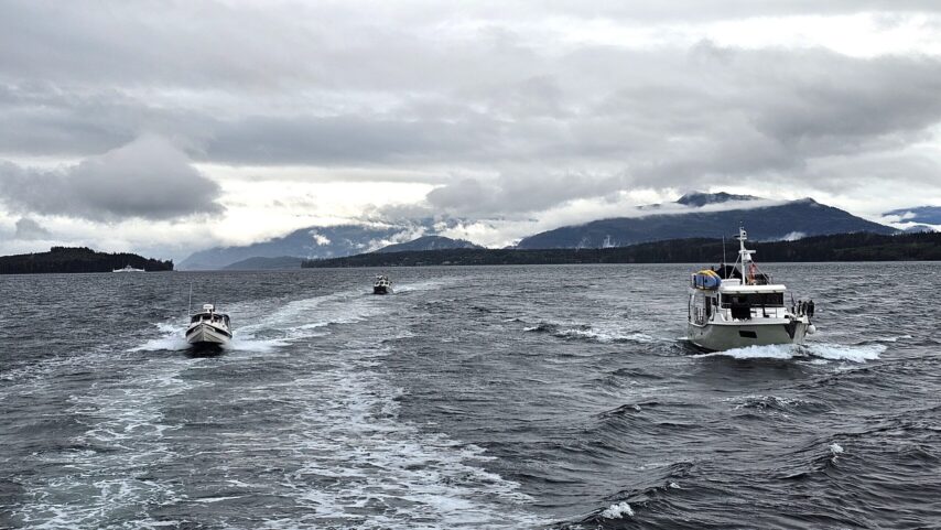
We continued out of Rescue Bay toward Jackson Narrows, our cut-through to Finlayson Channel. Those needing fuel would stop at Klemtu, while the slower boats would meander up and across Sarah Passage to continue on to Butedale. We all know the little guys outpace us—even with a fuel stop. Jackson Narrows is exactly that—narrow. From the east side where we would enter, it looked almost impassable, dauntingly tight. Lining up single file, we crept in. Small movements, clear communication kept us all moving forward. Just like that, we passed through the cramped corridor.
“All right, you guys, good job. Those that wish to speed ahead are welcome to do so.” The confidence in Kyle’s voice gave no hint of the mountain we’d faced earlier. “Roger,” came the chorus of replies over the radio.
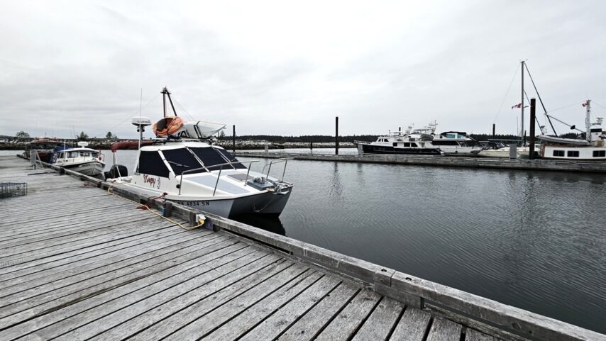
Then—“Uh, Stimpy calling Annie… I seem to be having a problem with my starboard motor. It doesn’t want to exceed 2,000 RPM.” Our eyes met. Minds already in motion, cycling through options and ways to assist. Kyle and M/V Stimpy began troubleshooting over the radio—describing symptoms, gathering engine details, and even looking up spares that might be needed.
C-Otter offered to stay with Stimpy and continue to Klemtu as planned, while Pacific Crest pressed forward. Dock space was limited, and even if the repair took a little time, the zippy C-Dorys would catch up in no time. After doing all we could underway, we decided to pull over too. C-Otter got fuel, and Stimpy and Annie met at the public wharf. We tied up to what seemed to be an abandoned fishing dock—old, dilapidated, and scattered with gear. Kyle and Bill got to work. A new symptom had emerged: the motor struggled to shift out of gear while docking. Kyle walked Bill through the steps—how to troubleshoot, what he suspected was wrong, and why. Cowling off, issue found, fix applied, cowling back on—faster than it took to tie up Annie. Then, off they went for a sea trial. Kyle took the helm. The fix held, and they were pleased with the results.
Turns out, the gear linkage had started to come loose—not broken, just nearly detached. It was still just functional enough to allow for forward propulsion, but not enough to get past 2,000 RPM.
On his way back to Annie from the fuel dock, Kyle stopped at the grocery store. We didn’t need anything, but it’s good to know what’s there—and there was a lot. Fresh fruit and veggies, ample dry goods; a surprisingly well-stocked temporary setup, considering the main store is under construction.
Mountain number two; climbed. And it was only 9:30 am. Annie departed the public wharf and continued up the west side of Cone Island. Our destination: Butedale.
It was an easy passage—47 nautical miles. A long day, but hopefully not as long as it had already been.
With permission granted to use the Butedale docks, we all eventually made it.
Tied up and secure, we handed out the evening’s “homework”: Surprise! The participants would be responsible for making their own daily brief, to be reviewed together at the evening potluck.
That night, we dined in Annie’s cockpit—no bugs and no rain made the weather too good to pass up. Captain’s Hour was long and full of laughter. We talked about weather, tools to predict weather, and how to read pressure systems. Of course, we wandered off-topic, but I’m sure someone could follow the breadcrumbs through our conversations.
It was the end of a beautiful day in a nearly eerie, deserted cannery—full of history and stories we could only begin to imagine.
One of our favorite stops. And, for the first time, we passed through without the dreaded bugs.
We wished each other goodnight and tucked ourselves in.
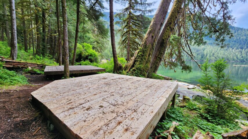
DAY 15 – BUTEDALE TO BISHOP BAY HOTSPRINGS
This stop wasn’t originally on our itinerary. We gained a day by skipping Frypan Bay in Penrose Marina Park to stay ahead of the weather. With that bonus day and a smaller group, Bishop Bay was the perfect place to spend some time.
Do you remember getting to the end of the school year, just so ready for summer? No classes, no bossy teachers, no being stuck in a stuffy little classroom? Oh, and no homework! Until… you find out you do have summer homework. Books to read, reports to write—what a bummer.
Well, sorry to say, our flotilla participants got a little taste of that today. For this leg of the trip, they had one assignment: do the daily brief. Yep, homework. Yesterday they were assigned a task to execute for this segment of the trip. Good news for them, the day’s run was an easy one.
After reviewing the “homework,” we decided the slower boats would depart at 7:00 am. That’s been working well for us. An early start also means an early bedtime—and I love that. We also wanted to stay ahead of the crowd. With the weather clearing up, a lot of boats had left Shearwater to continue north. And if there’s one thing we know about the hot springs at Bishop Bay, it’s that they’re a crowd favorite.
Today’s passage was about 22 nautical miles of clear, open, debris-filled channel. We left Butedale and entered Fraser Reach—where we’d spend most of the day. Once we neared Kingcome Point, we turned to head north into Ursula Channel. A calm, steady day. Early in the season like this, we tend to see more debris in the water than we would in August or September. At least that’s been our experience.
Then: Bishop Bay. And oh man, the sun finally came out to play. It was a beautiful day from start to finish. Once we arrived, there was space for the C-Dorys on the dock. Pacific Crest took the mooring ball, and Annie dropped anchor. Anchoring in Bishop Bay takes strategy, practice, and skill—it’s not for the faint of heart.
It didn’t take long before we both had our dinghies in the water, eager to soak our tired bodies in that warm spring pool. But first—more homework (much to everyone’s thrilled delight). We would go over it that evening on the dock, and share another little surprise.
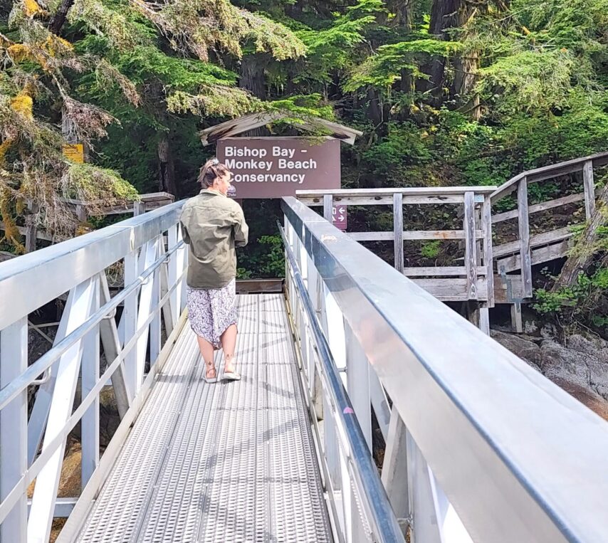
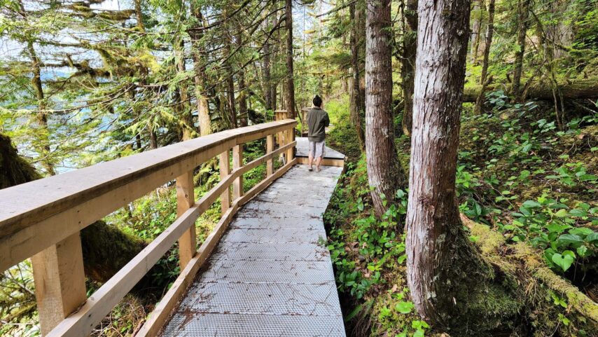
Some of us went for a walk, others jumped right into soaking. Eventually we all melted our worries away in that hot-spring-fed tub.
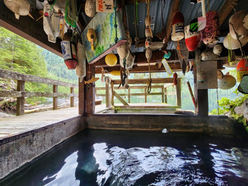
After soaking our bones in the hot springs, drying out, and filling our bellies with dinner, we reconvened on the dock.
But before diving too deep into tides and currents, we had a birthday to celebrate. I surprised Karen with a carrot cake topped with cream cheese frosting, and we sang her a slightly off-key “Happy Birthday” song. Her face lit up with surprise as we handed her a card signed by all of us flotillians. “I feel like a little girl,” she said, barely getting the words out behind her smile.
No surprise to us—Captain’s Hour was another success. We covered current through Grenville Channel and how to read the data using our “Ports and Passes,” a tool we’ve found handy just about every day. Service is sparse out here, and being able to flip open a book and find what you need? Invaluable. Grenville, in particular, can be a tricky one to time correctly.
With rain lingering in the clouds, we called it a night. Dinghies raised, coffee prepped; it’s off to bed we go.
DAY 16 – BISHOP BAY HOTSPRINGS TO KLEWNUGGIT
So far this trip, the weather has only come out to tease us. A sunny day here, a sunny afternoon there… but since about Day 6, it’s been mostly rain. By Day 14, we thought we were finally getting a break. But nope! We went to bed with rain and woke up to even more.
Today was a long haul for us slow boats, so we weren’t planning on much land exploration. We had 55 nautical miles to cover from Bishop Bay to Klewnuggit, where we’d anchor for the night.
To reach our next anchorage, we transited Grenville Channel; while it’s not known for the beastly temperament of Johnstone Strait, it can have wild currents and be a little confusing.
After departing Bishop Bay, we turned north into Boxer Reach, choosing the northern route around Gribbell Island. From there it was an easy cruise with beautiful views. We turned at Amy Point, heading southwest into Verney Passage. Keeping Money Point on Hawkesbury Island to starboard, we crossed Douglas Channel, where C-Otter peeled off to stop in Hartley Bay for some fuel. We dumped into Wright Sound, which led us straight into Grenville Channel.
We passed Lowe Inlet just after Noon—right on schedule to hit slack tide, so we weren’t riding much of a flood current. The rain hadn’t let up, and it showed no signs of stopping for the rest of the night.
As we meandered into our anchorage, we chose the East Inlet for the night. The smaller boats had already passed us and were comfortably settled at anchor. After circling a bit to find a good spot, we dropped the hook.
There was some light chatter over VHF once everyone was settled in, checking in on how anchoring had gone. Annie was dubbed the delivery service of the evening—“Annie-Dash”—tasked with delivering diesel and cream to Stimpy as needed.
We readied the dinghy, and Captain Kyle made the rounds to give the daily briefs. It was a quick one that night; everyone seemed tired from the long run.
In bed by 7:00 pm, Annie was already prepped for the 5:30 am departure the next day.
With our experience as boat delivery captains, Kyle and I reflected on how leading a flotilla felt different. Instead of delivering vessels, we were delivering people—sharing knowledge, and experience, wrapped in a sense of security. In that moment, we both agreed this was our favorite delivery yet.
DAY 17 – KLEWNUGGIT TO PRINCE RUPERT
It’s the early mornings that remind me of how differently traveling by boat is than by car. Bill, one of our participants said it best “the road doesn’t move underneath you when your driving.” Man, did we all get a good laugh out of that.
We departed Klewnugget at 5:30 am to catch the out going tide in Grenville Channel. This gave us about a 1 to 1.5 kt push. We had some following seas with light wind off our stern. It became a great long wet day of 50 nm.
From Grenville we continued into Author Passage, keeping Kennedy Island to starboard. Once we started approaching Marcus Passage, between Kennedy Island and Smith Island, the weather shifted. We got winds off our starboard side, coming across our beam making for a rougher ride. It was steady 20-30kts with gusts up to 40kts. The rain would pound, and run across the windows. A steady reminder of who was in charge.
We pressed on, across Porpoise Channel, past Lima Point, into Prince Rupert Harbor. Oddly enough, this is where the ride always seems to be the longest for me. So close to our sanctuary, yet so far.
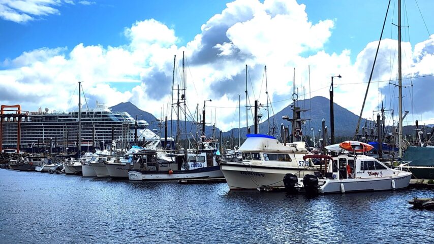
Prince Rupert has always been a favorite stop of ours. The last stop before the jump to Alaska! The local grocery store seems to have what we need, and there are plenty of places to get a great bite to eat.
We also made stops at the Meat shop, stocking up on Pot pies, Shepard pies, breakfast sausage, Bison Jerky, a steak for the “bring your own meat” celebratory BBQ we will have on our last night together. I could go on.. Crab cakes, chicken-cordon-blue.. I think that sums up what we got. There was plenty more to eye over. Truly a great place to shop for meats. We made a couple stops at local marine stores. Sea-Sport to get a Garmin inReach mini, and a stop at Pacific Net & Twine Ltd. for some fishing ends and bits.
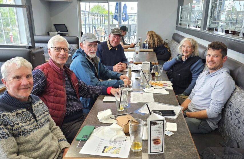
We gathered the crew and headed to Opa Sushi for dinner that night. We talked weather, routes, what to expect in Ketchikan and so much more.
After dinner, we gathered aboard Annie to go over our daily brief. We set up Scott’s Garmin inReach and talked weather some more. It was here we made the final decision to go for it, with a 6:00 am departure.
DAY 18 – CROSSING DIXON ENTRANCE TO KETCHIKAN, AK
Today was the last big one: Dixon Entrance. 82 nautical miles all the way to Ketchikan, with only a narrow weather window ahead of us. That meant an early 6:00 am departure. It was going to be a long day for all of us. Kyle and I have had some of our worst crossings at Dixon, so we were very focused on preparing our flotillians for this leg.
Whether you’re out in your backyard or on an adventure 500 miles from home, you never expect the bad. Time keeps moving. Life carries on—even when your world feels like it’s come to a dramatic halt. The unknowns that come with medical scares always feel bigger when you’re far away. Our bodies—always changing, aging, and sometimes leading us astray—don’t come with a crystal ball to help us predict what’s ahead. We just have to keep going. Take the day as it comes, keep our heads up, swim harder, and press on. Tell yourself, “This isn’t it,” and ask, “What can I do?”
We’re never truly prepared for the scary things—but they come. It’s not if, but when. So, get travel insurance. Make the plan with someone. Decide when and how you’ll check in. And then—check in. Do the thing that brings an extra layer of comfort and safety to your journey.
This boating community—new or seasoned—amazes me. The way you can bring a group of strangers together and watch everyone step up for each other… it’s beautiful, and it never stops impressing me. Whether it’s someone needing toilet paper for the outhouse at Bishop Bay, a little diesel for their stove, or cream for their coffee—there’s always someone there saying, “Don’t worry. I’ve got what you need. We’re in this together. Here, take my hand.”
And while those may seem like small things, I’ve seen the bigger ones too. Parts being run up the Inside Passage, dock walks with tool bags where someone is bound to offer a hand before you can ask. It’s just the way it is.
We had met another boater several stops back—his first time doing the Inside Passage. We’d chatted, offered a few tips, suggestions, and weather notes. Shared our plans and heard his. It’s funny how if you see someone once, you’re almost guaranteed to see them again. And sure enough, we ran into him again in Prince Rupert, right before the big crossing.
He was nervous. He asked when we were crossing. We talked weather and shared our plan. He wasn’t sure what he was going to do. We offered him a spot to “Mother Goose” with us—he fit right in with his 25′ C-Dory. And join us he did.
Around 5:30 am, we walked the docks, checking in with everyone—confirming routes, and making sure each crew felt good about the day ahead. The night before, we’d decided I would ride with Pacific Crest to give their captain a break if needed. One by one, we got everyone off the dock: Annie, C-Otter, Stimpy, and then Pacific Crest. We were headed through Venn Passage—where organization and clear communication are key for navigating narrow waters smoothly.
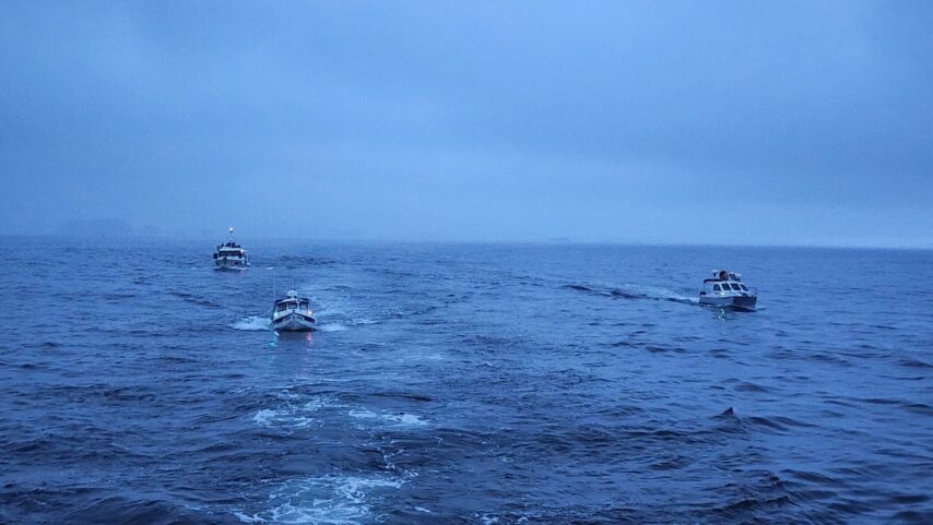
Once we cleared Venn, we nosed up past Duncan Bay into Chatham Sound. The weather was perfect, just as forecasted—following seas, a light wind from the south, and a current pushing us along. You couldn’t ask for a better Dixon crossing. Like honeybees leaving the hive, each boat found its own comfortable pace. Dixon was kind to us—she gave way, allowing us across and into Revillagigedo Channel.
Slowly, we pressed on—up, up, up—into Tongass Narrows, into Bar Harbor, and finally tucking in to our slips. The wind was picking up, but we made it.
Somehow, even after spending all day “just sitting” on a boat, you land ravenous—as if you’d walked miles or completed some grueling physical feat.
We celebrated our crossing, as it truly deserved to be, with dinner at the Alaska Fish House. Never a disappointment. We left full and happy.
On the way out, we stopped at a chart on the wall—a zoomed-out view of Alaska all the way south to Washington. Watching our flotilla participants gaze at it, realizing how far they’d traveled, was something special.
“Pretty crazy, huh?” Kyle said to C-Otter.
All he could do was nod, eyes locked on the chart, too overwhelmed to speak.
Exhausted from the day—and with no daily brief to plan—we all called it a night. We had a full day to rest in Ketchikan. We all needed it.
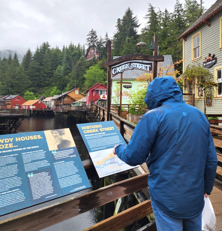
DAY 19 – A DAY IN KETCHIKAN
Finally, a day to rest. Well—sort of. A day without travel is never truly restful for us.
Kyle and I had a bit of work to handle aboard one of the participant’s boats, but after that, the day was ours to explore. Naturally, we started at the top of the ramp with a mid-day coffee from B & D Espresso—nothing begins quite right without caffeine.
We wandered into Tongass Trading Company where we planned to meet a few of our flotillians. Tongass has a few stores scattered around town, but the one near Safeway is the go-to for marine and fishing gear. Once our group had gathered, we braved the steady drizzle and set off on foot toward downtown—about a mile walk in the rain.
Being Memorial Day, we knew not everything would be open, but we had a few spots in mind. First up, lunch. We were on a mission for soup. After strolling past a few closed diners, we landed at Annabelle’s Famous Keg and Chowder House. With three kinds of chowder on the menu, we were sold. Warm bowls in hand, we thawed out from the chill and happily filled up.
But Ketchikan had more in store—and more rain. Bundled once more in our wet weather gear, we headed to Creek Street to explore this iconic historic district. It’s still early in the season, so the salmon haven’t begun their dramatic run upstream to spawn, and the usual line of hopeful anglers on the bridge were missing. Still, we wandered the wooden boardwalk, reading signs about the colorful past of this former Red Light District.
At the far end of Creek Street, we found Star Gallery, a cozy art shop showcasing the work of local artists of different mediums. I snagged a few treasures—carefully stopping myself before I bought everything in sight.
We ducked briefly into the Tongass Historical Museum but didn’t have much time before we had to head back to the harbor. Some of our group still had errands at Tongass Marine before closing time. I made a quick stop at Safeway to grab supplies for dinner, tacos were on the menu tonight.
Though the sun never came out, it didn’t stop us from soaking up the spirit of the day. As evening settled in, we gathered slowly for captain’s hour over warm food, laughter, and stories. We finished with still-warm chocolate chip cookies while pulling out the planning maps.
Now begins the conversation about the return journey—routes, timing, tides. We marked up the maps, highlighted Seymour Narrows, and discussed strategies for heading back south. The chatter stretched on well past bedtime.
Finally, we said our goodnights and retreated to our boats. We’d walked many steps, soaked in many sights, and tomorrow would start early—Annie with a cast off at 7:30 am, with the C-Dorys following by 9:00 am.
DAY 20 – KETCHIKAN TO MEYERS CHUCK
 Two of the most consistent things on this adventure so far has been the rain—and the memories. While the latter is everything we’re out here for, the former… not so much. I could’ve done without the endless downpour. May is supposed to be one of the “drier” months in Southeast Alaska—emphasis on the “-er,” I guess.
Today’s passage was about 32 nautical miles. Annie pulled away from the dock around 7:30 am, aiming to catch the current up through Tongass Narrows, hit slack tide as we enter Clarence Strait, and then ride the flood north.
The wind had died down, and what little remained came from our stern, just as expected. The channel was scattered with debris and eerily quiet—few boats on the move. Boats that we did cross paths with ended up at Meyers Chuck too.
Luckily, there was room for everyone at the dock, and we all nestled in. Right on cue, as if Mother Nature had been waiting for us to secure our lines, the wind flipped back on, like a light switch.
Once we were secure and settled in for the blustery night, we went exploring. Trails lead away from the dock in both directions, winding through the trees around the bay. We headed south to the beach that faces out into Clarence Strait. The tide was ebbing, and the waves were steep—just a hint of the weather brewing for the night ahead.
It had been a mellow day, despite the rain, and the evening followed suit. We gathered for a group dinner of enchiladas—warm, comforting, and exactly what the day called for.
After our usual captain’s hour, we spent some time helping C-Otter sort out post-flotilla plans. We pointed out highlights on his planning chart, shared extra tips and tricks we’ve picked up over the years, and talked anchoring—scope, swing radius, and the finer details that come from experience.
It may have been an “easy” day, but we were all spent. More than ready to crawl into bed and drift off with the promise of Cassy’s fresh cinnamon rolls waiting for us in the morning.
DAY 21 – MEYERS CHUCK TO WRANGELL
Have I mentioned that it’s been raining? And not the charming Seattle drizzle kind—no, this has been wet, soggy, relentless rain that seeps into everything. The kind you feel all the way down to your bones. And it hasn’t stopped. Like a stubborn cloud looming above us, collecting every other raincloud in its path, following us wherever we go. But still, it doesn’t deter us.
We’re up early, ready for the famous cinnamon rolls that arrive promptly at 8:00 a.m. at Meyers Chuck. Cassy is such a delight. She is bright, warm, and smiling as she brings extras to sell on the dock for those who forgot to order ahead. Unlucky for them, but lucky for me… I bought four more. As if we needed four extra cinnamon rolls. But honestly? They’re just that good.
We chatted briefly—small talk that felt like catching up with an old friend. Then, just as quickly as she came, Cassy was off, disappearing into the morning mist.
Annie had planned to depart at 09:00 am, but nature had other ideas. The wind was howling out in Clarence Strait. We walked out to the old telephone tower, where you can stand on the helipad and see out to sea. The tide was so low we were able to walk along the shoreline from there to the beach access along Clarence Strait.
Wow, I was practically blown over just walking out to the point. That alone was enough to convince us to stay put. If the wind wasn’t warning enough, the whitecaps and standing waves clinched it. We were looking at a north-to-south current clashing with strong southerly winds—and it showed.
We knew the weather was supposed to calm, and slack tide was approaching, so we opted to enjoy a slow morning. We walked the trails, chatted with other cruisers on the dock, and waited.
Our goal was to leave around noon to catch the favorable current through Zimovia Strait. The C-Dorys, with their speed, could afford to wait a little longer and still catch the push.
Just before casting off, we could feel the wind finally beginning to ease. This was our moment, so we took it. By 12:30 p.m., we were off the dock and making our way out of the bay.
We confirmed with the C-Dorys that they’d wait another hour, ducking inside Misery Island to stay in the lee as long as possible. That route would give them shelter until they passed Lemesurier Point, where they’d find protection again.
From there, it was smooth sailing all the way to Wrangell. The wind mellowed, the waves subsided, and the rain… well, the rain stuck around. Hopefully with its bags packed, ready to leave any minute now.
We tied up at Heritage Harbor in Wrangell, tired and ready for a hot meal. A 1.5-mile walk later, we arrived at Hungry Beaver Pizza—hungry (of course) and, surprise surprise, soaked. Thank goodness for rain gear.
Dinner was slow and satisfying, but the thought of the long, wet walk back dampened our spirits slightly. We considered waiting out the rain… but with no break in the clouds and the sun slowly setting, we set off.
It’s been three full weeks. Long, full weeks—brimming with excitement, adventure, memories, and dreams realized. We’ve shared knowledge, stories, laughter, and rain-soaked experiences.
As we wandered slowly along the docks, admiring boats and whispering final thoughts of the day, we bid each other goodnight.
DAY 22 – A DAY SPENT IN WRANGELL
When we first arrived in Wrangell, I have to say that our spirits were a bit low. We were all tired and soggy-wet. Some in our group were ready to press on to Petersburg in search of sun. Rumor has it there’s a sunny part of Alaska somewhere.
Still, we decided to stay. We were all overdue for some R&R—walking, wandering, and simply exploring. So that’s exactly what we did.
When we woke in the morning, the first thing we noticed was… silence. The absence of “Pitter Patter” on the roof. Was this it—had our break finally come? Emerging from the depths of our warm, dry cocoons, we peered out the windows. YES. In fact, our break was here! With only a 37% chance of rain—the lowest we’d seen in nearly two weeks— We were excited. WOOHOO! Let me tell you, we were going to take full advantage of it.
Fresh showers all around, we gathered on the dock and prepared to leave Heritage Harbor. Instead of trekking the two miles into town, we all piled onto Stimpy and rode over to Etolin Harbor to tie up in the guest moorage space.
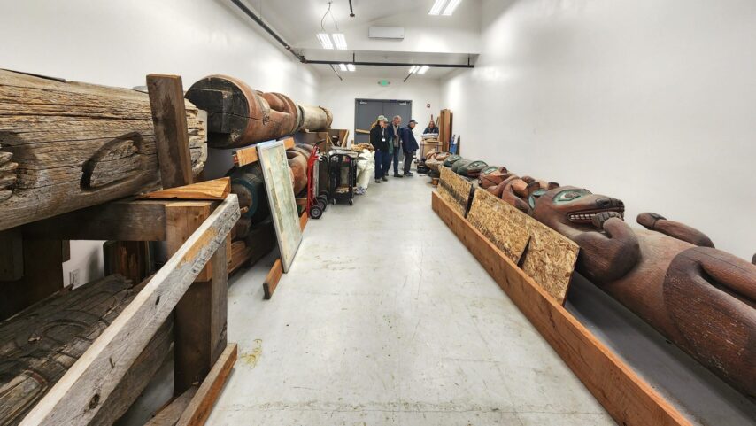
Later, while walking behind the Culture Center, we met Johnny—one of the wood carvers commissioned to rebuild one of the totems. His work was beautiful, his patience vast, and his knowledge deep. He answered our many questions with generosity, even taking the time to show us around. We got to see an album of his own work and hear stories about some of his original pieces.
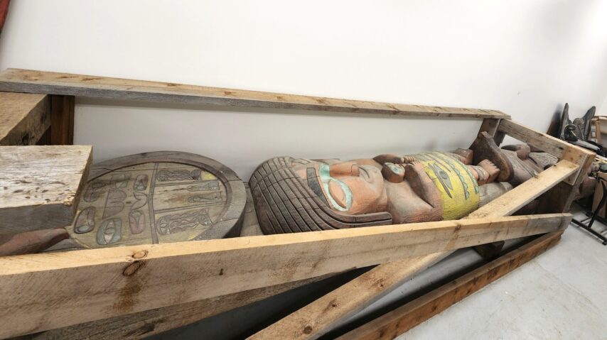
With 52 years of experience in woodworking, you can tell his hands are storytellers. Grateful for his time, we felt honored to hear everything he was willing to share.
After the “longhouse,” which we learned is actually a “Shake House,” we strolled into town, passing the Hungry Beaver where we dined the night before. Naturally, we stumbled upon a marine store first—The Bay Company. Though it’s listed as a boat dealer, they are so much more. One of our participants even scheduled their 100-hour service with them for the return trip.
I wandered down to the thrift store just a few doors away, then met back up with the group for a delicious lunch at Michelle’s Taste of Asia.
Continuing down Front Street, we meandered in and out of gift shops, clothing stores, and those charming little stores that seem to carry a bit of everything. Everyone found a treasure of some kind. We eventually made our way to the museum on Campbell Drive.
Along the way, we met many locals—all welcoming and clearly involved in their small, homey town. Preparations for the Fourth of July festivities were already underway, with events scheduled to begin as early as June 28th.
From the museum, we made our way back to the marina to drop off our treasures and retrieve C-Otter from the other dock. Both vessels would stay in Etolin Harbor for the night.
Dinner was a true treat: a lovely meal at Stik Restaurant & Lounge—an anniversary gift for Kyle and me from our participants. It was a beautiful surprise, and one we won’t forget.
After dinner, we gathered back on the dock at Etolin, shared cake, and held our final daily brief of the trip with this group.
Bittersweet doesn’t quite cover it. We’ve led these incredible people, day by day, over 800 nautical miles. So far from home, we’ve built a bond that’s unlike anything we’ve had with customers before.
More than customers—people who began this journey as strangers have become friends. With us and with each other—memories and people we’ll cherish forever.
DAY 23 – WRANGELL TO PETERSBURG – The Final Push
Well, here it is, the last day we all travel together. It feels like so much more than 23 days ago that we first pushed off as a group. The challenges faced, connections shared, and memories made amount to something far greater than just three weeks’ worth of time. With only today and tomorrow left as our official time together, each moment feels a little sweeter.
We woke up to—yep, you guessed it—more rain. The clear skies didn’t last as long as we were hoping. Today’s journey covered 40 nautical miles, from Wrangell to Petersburg, through the famed Wrangell Narrows. If you’re unfamiliar with it, the Narrows are a long, winding channel—21 miles end to end—with a current that changes direction about three-quarters of the way through. The max current is around 4.5 knots, making timing especially tricky. Don’t let that “low current” count fool you, Wrangell Narrows is another beast even the locals time well.
Our boat was docked in Heritage Harbor, which meant quite the walk over to the C-Dorys in Etolin Harbor. The morning’s plan was to go over the route with Bill aboard Stimpy. With slack current not expected until late afternoon, we had time to spare this morning. Highlighters out, notepads ready—we mapped the route with Bill. Bill was prepared: bail-out points before and after each stop, miles counted, alternatives noted. He also mapped a trip through the Misty Fjords east of Ketchikan for his return journey. During this time; some folks did laundry, others wandered the town.
We needed to be off the dock by about 12:30 pm to time our arrival at slack in the Narrows. On our walk back to Annie, we ran into a local we’d met the day before. Plans were made to go fishing together later this summer. Once underway, we slipped easily into the routine we know so well.
As we approached Wrangell Narrows, the C-Dorys caught up. To play it safe, we “Mother Goosed” it through, staying together in formation. While they could maintain higher speeds and slow down in the no-wake zones, we kept to a steady pace, about 9 knots with a 2-knot push. We bobbed and weaved through the markers like a pinball in slow motion, carefully threading the needle through the channel.
The miles fell away as fast as 9 knots would allow. Before long, we’d made it. One by one, we hailed the harbormaster in Petersburg for slip assignments. Once tucked in, we wandered into town for dinner. Inga’s Gallery is a favorite of ours, a must-stop every time we pass through.
Though the evening was still young, we were spent—our bodies craving sleep, our minds parched for rest.
These 23 days show in the weariness we all feel by nightfall, especially on travel days.
Tomorrow is our final day together. It begins with a jet boat tour and ends with a farewell BBQ. Then we bid adieu and return to the tubs we call home.
DAY 24 – PETERSBURG – Le Conte Glacier & Celebratory BBQ
Today marked our final day together as a flotilla but not our last day together as friends.
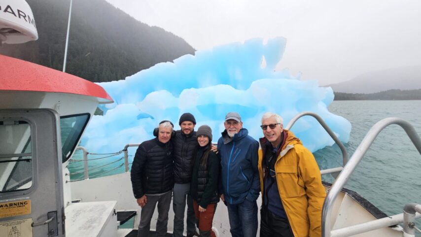
We were looking forward to a glacier tour scheduled with Seek Alaska to visit Le Conte Glacier. And let me tell you, she does not disappoint.
We started the morning off right with breakfast from Salty Pantry. Online, they’re listed as a “bakery,” but that hardly does this small store bursting with flavor and character justice. Their display case was overflowing with hot, freshly prepared breakfast items that exceeded all expectations. No set menu—what you see is what you get—and what we saw made choosing nearly impossible. There was everything from scramble, ham croissant sandwiches, veggie quiche, sourdough toast with egg and gravy… the list went on. Kyle opted for the giant biscuit sausage breakfast sandwich. I had a breakfast taco wrapped in a crispy cheese tortilla. Yum! We also grabbed a just-out-of-the-oven rhubarb turnover, filled with fresh locally picked rhubarb. It was standing-room only with a line to the door.
From here we meandered down the dock for our 9:00 a.m. departure aboard the Seek Alaska jet boat. Rob, our captain for the day, is a fourth-generation fisherman and lifelong local. His son takes over the tours once the fishing season begins. From the moment we cast off, it was clear this was a route Rob could run with his eyes closed, beyond the web of tracks visible on the screen.
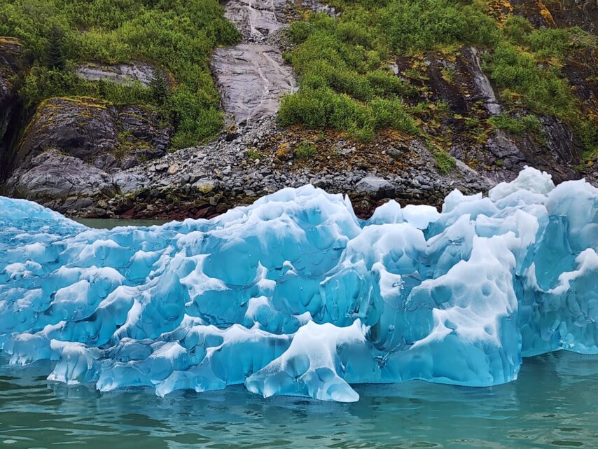
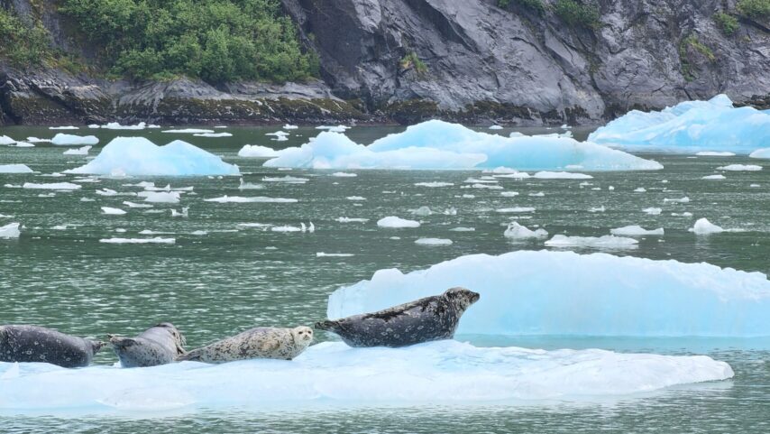
The rain lingered, teasing us with the promise of clearing. As we approached the glacier, icebergs began appearing like sentinels leading the way. Their shapes, sizes, and glacial blues defied imagination. What began as mild excitement quickly morphed into jaw-dropping awe with each turn of the fjord.
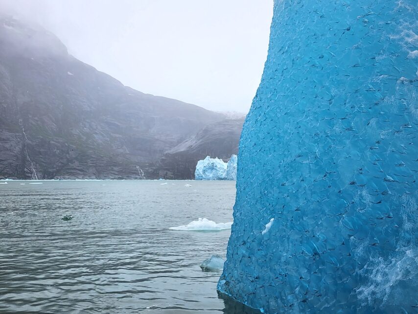
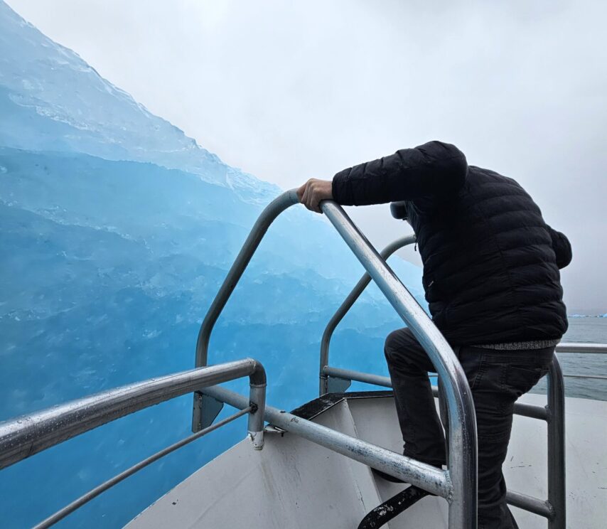
The air temperature dropped another 10 degrees—we were getting close. Turning the final corner, the narrow passage opened and there she was: Le Conte Glacier in full, breathtaking view. Photos could never do her justice. Captain and crew worked in unison, threading the boat between icebergs to bring us right up to her face.
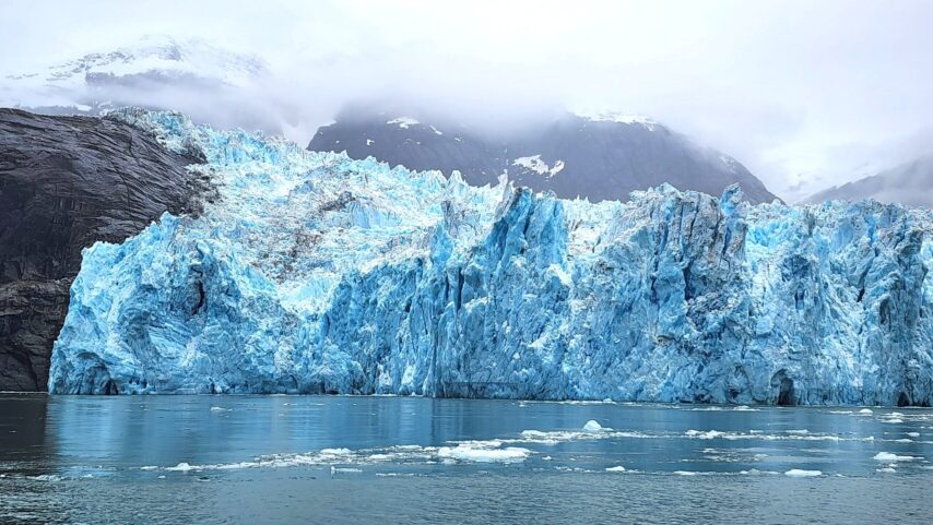
We watched, wide-eyed, as small pieces fell from the glacier. Left! Right! Center! Our heads darted around, trying to catch every moment. Then it happened—a deep rumble, and suddenly a massive calving, a large piece broke free from the center of the ice wall. Thunder cracked across the bay, silencing even our cheers. The ice plunged downward, eventually to pop up again. Before the chunk was done rolling, it was being swept away by the powerful waves churning beneath the glacier.
Stunned by the raw power and beauty, we were frozen in place. The captain eventually called it—time to go. It was the only thing that could pull our eyes away. We could have stayed there all day. But the ice was closing in and we had already overstayed our welcome. Crew climbed to the roof, the captain stayed steady at the helm, and together they navigated us out through the maze of bergs that held us captive. Finally free, we kicked up to a 30knot push and zipped back to Petersburg.
Once docked, the day’s chatter resumed—stories tumbling out from everyone. Kyle and I made lunch aboard Annie, still humming from the chill and wonder. There’s something about the breeze off an 18,000-year-old ice wall that cools you straight to the bone.
After warming up, we wandered through town—the bookstore, gift shops, and parks that hinted at the area’s rich history. Dinner crept up quickly. Tonight was our farewell BBQ.
The menu: brats, steaks from Prince Rupert, potatoes, freshly baked bread, and cabbage. The main course was not the food—it was the laughter, the memories, and the deep appreciation for how far we all came. Everyone signed our burgee as a celebration of the journey and a keepsake for the future.
Hugs and final farewells rounded out the evening. Our hearts tugged as we said goodbye to these strangers who have become friends. Dreams have bubbled into truth and met reality head-on—strong, proud, and ready. As their guides and protectors, we wished our participants well. Ready to chart their own course, onward and outward. They carry a badge of pride, earned and worn like a passage token—something that says, you’ve done it. You belong here. No longer just guests, they were now fellow boaters of the Inside Passage.
It’s not goodbye, just see you later, my fellow salty sailors.
We wish you fair winds and following seas,
we will see you out there.
Annie standing by, 1-6, 6-9.